
Sign in
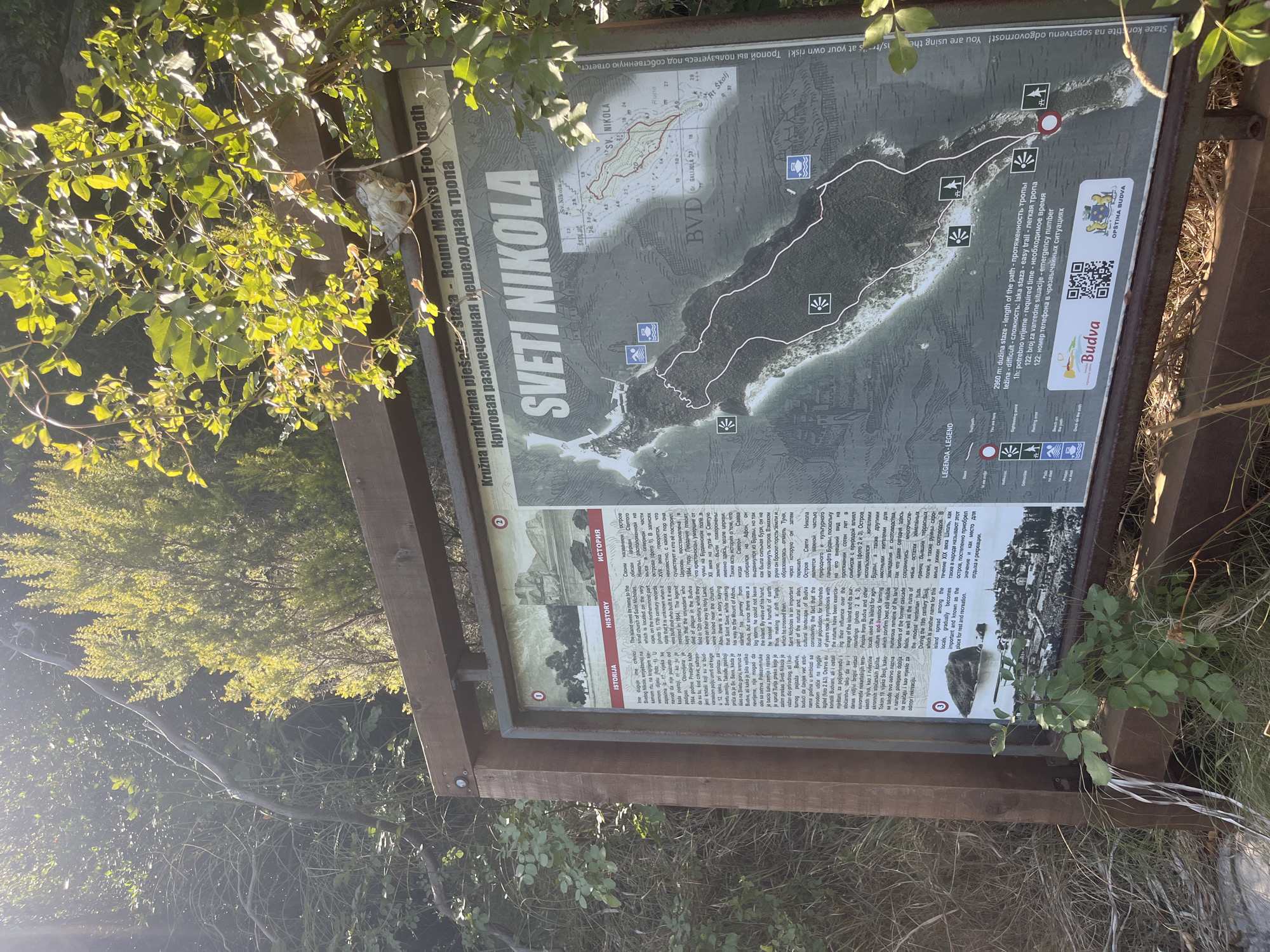
The image shows an information board located in Budva, Montenegro, specifically detailing the "Sveti Nikola" round marked footpath. The board is mounted on a wooden frame and stands outdoors, surrounded by foliage. The main subject is the information board itself, which features a map of Sveti Nikola island, text in multiple languages (including English, Montenegrin, and Russian), and various icons representing points of interest and trail conditions. Text on the board indicates "Sveti Nikola" as the name of the location and "Round Marked Footpath" as the type of trail. The map shows the contours of the island and a marked path winding through it, with points numbered 1 through 3. The "LEGENDA / LEGEND" section explains the symbols, including "Sightseeing point", "Floating area", "Beach on the path", and "Dock on the path". It also states the length of the path as "2960 m" and the required time as "1h". Below the map, the Budva coat of arms and a QR code are visible, along with the text "Opština Budva" (Municipality of Budva). The environment appears to be natural and sunny, with trees and branches encroaching on the top and sides of the board. The lighting suggests it is daytime.
ankor

Aug 20, 2026, 9:58 AM

Budva, Montenegro

Stake attention in this memory

exploratory
informative
natural
peaceful
historic

The image shows an information board located in Budva, Montenegro, specifically detailing the "Sveti Nikola" round marked footpath. The board is mounted on a wooden frame and stands outdoors, surrounded by foliage. The main subject is the information board itself, which features a map of Sveti Nikola island, text in multiple languages (including English, Montenegrin, and Russian), and various icons representing points of interest and trail conditions. Text on the board indicates "Sveti Nikola" as the name of the location and "Round Marked Footpath" as the type of trail. The map shows the contours of the island and a marked path winding through it, with points numbered 1 through 3. The "LEGENDA / LEGEND" section explains the symbols, including "Sightseeing point", "Floating area", "Beach on the path", and "Dock on the path". It also states the length of the path as "2960 m" and the required time as "1h". Below the map, the Budva coat of arms and a QR code are visible, along with the text "Opština Budva" (Municipality of Budva). The environment appears to be natural and sunny, with trees and branches encroaching on the top and sides of the board. The lighting suggests it is daytime.

Loading AttnAds…

transactions
revenues
stakers
Earliest
Latest
Highest stake

No transactions found

More from this user

More from Budva

ankor

Aug 20, 2026, 9:58 AM

Budva, Montenegro

Licensed under Creative Commons Attribution 4.0 International License. You are free to share and adapt this content with proper attribution.