Stake attention in this memory
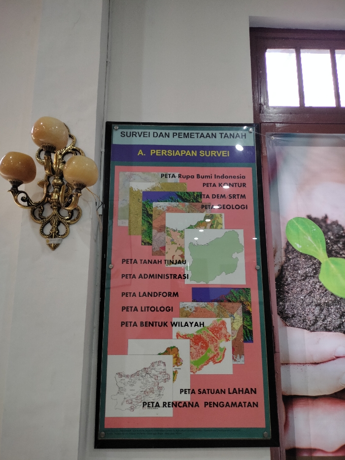
An indoor, eye-level shot captures a display board and a decorative wall sconce in what appears to be a public or educational setting in Bogor, Indonesia. The ornate gold-colored wall sconce, featuring three amber-toned, globular light fixtures, is mounted on a white wall to the left. To its right, a rectangular, framed display board with a pink background presents information titled "SURVEI DAN PEMETAAN TANAH" (Land Survey and Mapping) and a section header "A. PERSIAPAN SURVEI" (A. Survey Preparation). The board lists various types of maps, accompanied by small illustrative examples. These include: "PETA Rupa Bumi Indonesia" (Topographic Map of Indonesia), "PETA KONTUR" (Contour Map), "PETA DEM/SRTM" (Digital Elevation Model/Shuttle Radar Topography Mission Map), "PETA GEOLOGI" (Geological Map), "PETA TANAH TINJAU" (Soil Survey Map), "PETA ADMINISTRASI" (Administrative Map), "PETA LANDFORM" (Landform Map), "PETA LITOLOGI" (Lithological Map), "PETA BENTUK WILAYAH" (Regional Shape Map), "PETA SATUAN LAHAN" (Land Unit Map), and "PETA RENCANA PENGAMATAN" (Observation Plan Map). To the far right, part of a wooden window frame is visible, allowing daylight to enter. Adjacent to the display board, a portion of another display case or poster is seen, featuring a vibrant green seedling sprouting from dark soil, gently cradled by a pair of hands. The scene is brightly lit, likely by the natural light from the window.
No transactions found