Stake attention in this memory
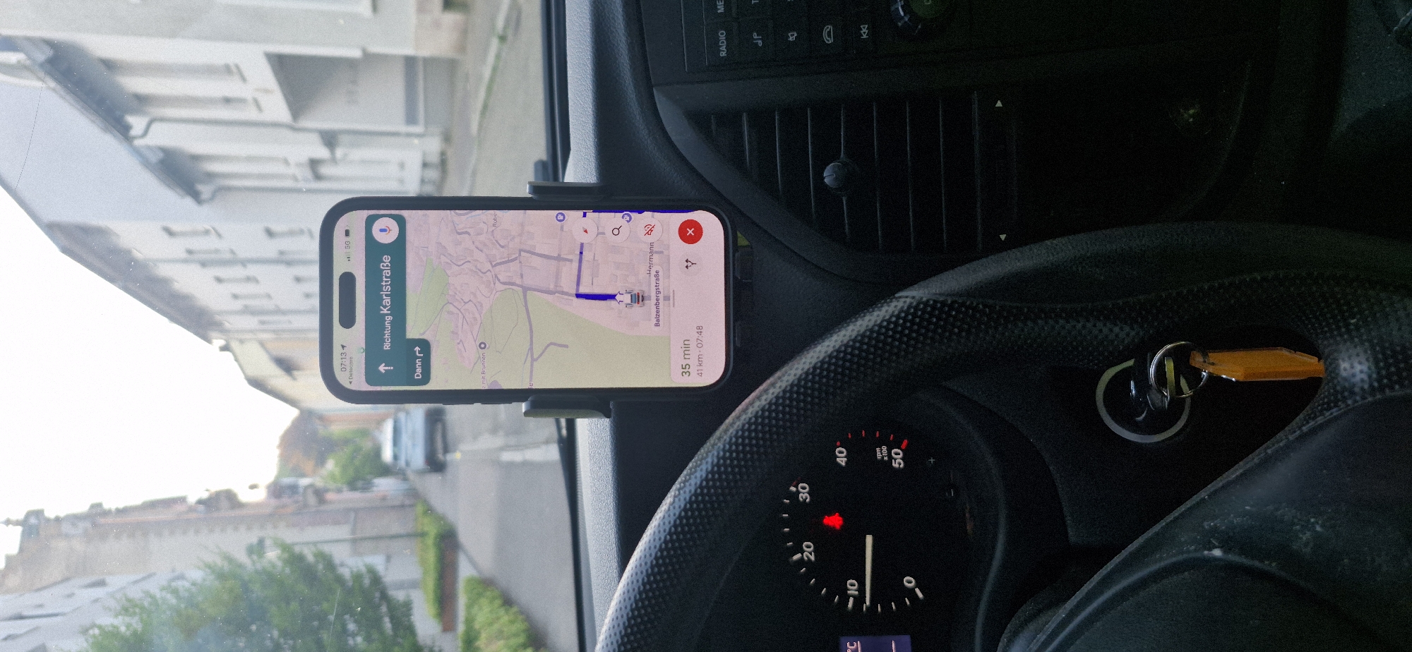
The image displays the interior of a vehicle, looking forward through the windshield. A smartphone, mounted on a dashboard holder, is displaying a navigation app. The app indicates a route to "Richtung Karlstraße" (Direction Karl Street) with an estimated travel time of 35 minutes and a distance of 41 kilometers. The map shows a route through what appears to be a town or city. Visible in the foreground are parts of the steering wheel and the dashboard. To the left, a car's instrument cluster is partially visible, showing a speedometer with a needle indicating around 15 km/h. A red warning light is illuminated. A set of keys with an orange tag is in the ignition. To the right, part of the car's center console is visible, including air vents and radio controls. The scene outside the car shows a street lined with buildings on both sides. Trees and greenery are visible along the side of the road. A silver car is ahead of the vehicle. The overall lighting suggests it is daytime, possibly early morning or late afternoon, given the soft sunlight. Based on the navigation app's destination, "Karlstraße," and the general architectural style visible, the location is likely Baden-Baden, Germany, as Karlstraße is a known street in that city. The context of the navigation app suggesting a 41 km journey further supports a plausible route within or leading out of a city like Baden-Baden.
Symbol
BC184
Volume
11,550
Creator
+$0.12
Revenue
+$0.21
TVL
$9.60
2
Rev Bot 🤖💰
Injected revenue 2h ago
“Revenue bonus for the last stake.”
+$0.24 USD