Stake attention in this memory
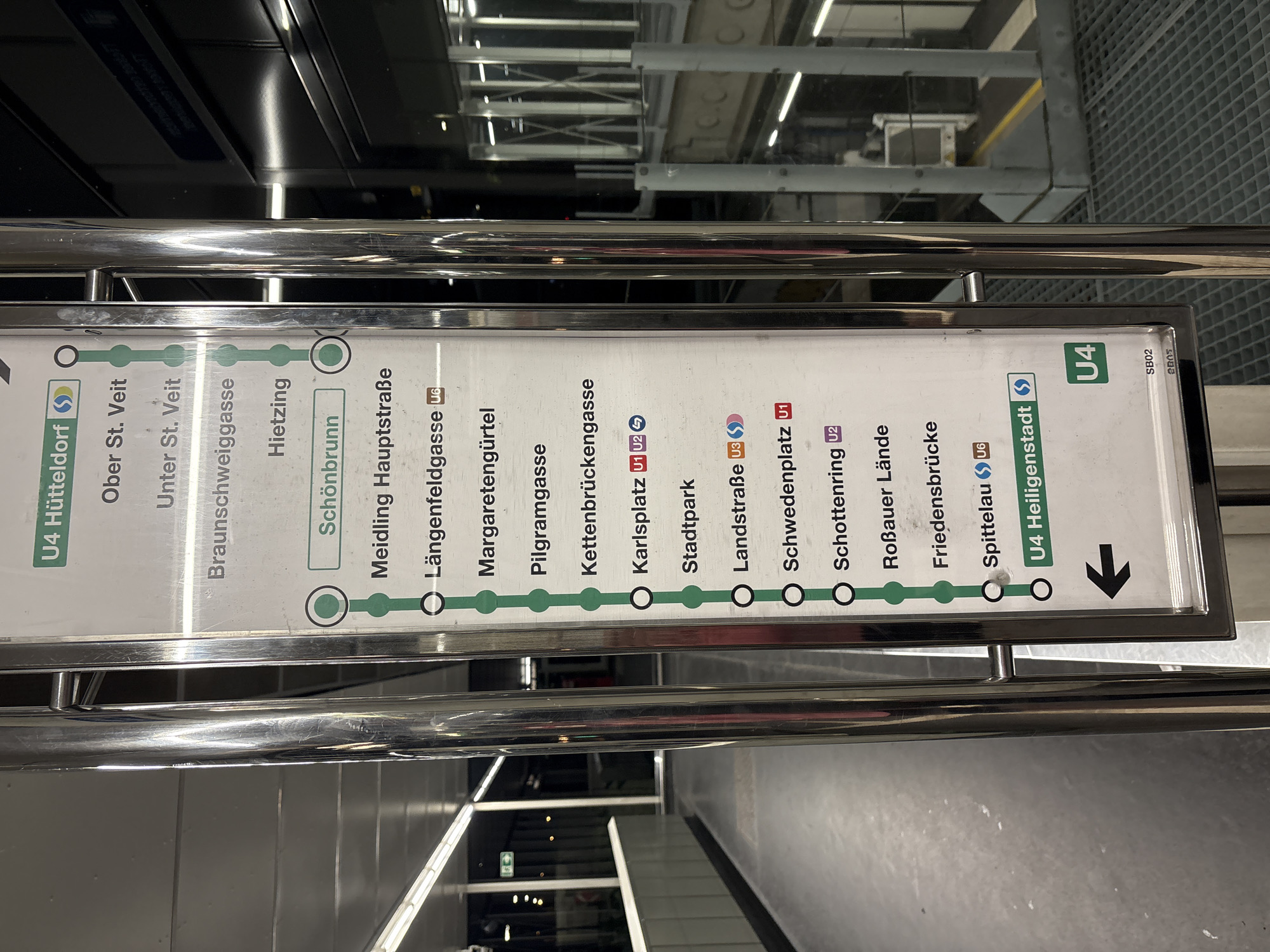
The image shows a close-up of a subway map in Vienna, Austria. The map is mounted on a chrome-plated pole and displays the U4 subway line, with stations listed from top to bottom: Hütteldorf, Ober St. Veit, Unter St. Veit, BraunschWEIGGASSE, Hietzing, Schönbrunn, Meidling Hauptstraße, Längenfeldgasse, Margaretengürtel, Pilgramgasse, Kettenbrückengasse, Karlsplatz, Stadtpark, Landstraße, Schwedenplatz, Schottenring, Roßauer Lände, Friedensbrücke, Spittelau, and Heiligenstadt. The U4 Heiligenstadt station is highlighted at the bottom, with an arrow pointing left, indicating the direction of travel. The background shows a blurred view of a subway station platform with a dark ceiling and reflective surfaces. The overall impression is of a clean and modern public transportation hub.
No transactions found