Stake attention in this memory
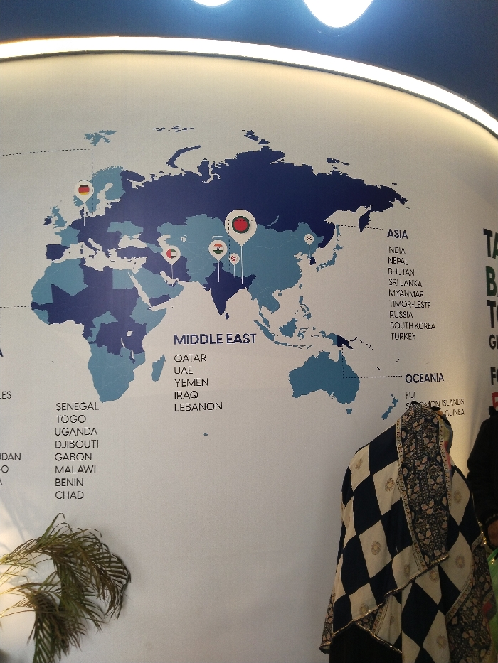
The media file displays a large, illuminated wall map of the world, likely in an indoor setting such as an office or exhibition space in Purbachal, Bangladesh. The map uses two shades of blue to distinguish landmasses. Several pushpin-style markers, each featuring a national flag, are strategically placed on various countries including Germany, the United Arab Emirates, India, Bangladesh, and Japan, with another flag visible in East Asia. To the right and left of the map, lists of countries are categorized by region. Under "MIDDLE EAST," the visible countries are QATAR, UAE, YEMEN, IRAQ, and LEBANON. The "ASIA" section lists INDIA, NEPAL, BHUTAN, SRI LANKA, MYANMAR, TIMOR-LESTE, RUSSIA, SOUTH KOREA, and TURKEY. "OCEANIA" includes FIJI, SOLOMON ISLANDS, and CUINEA (likely Papua New Guinea). On the far left, a partial list of African countries is visible, including SENEGAL, TOGO, UGANDA, DJIBOUTI, GABON, MALAWI, BENIN, and CHAD, along with fragments like "LES" and "DAN". In the bottom right, a person is partially visible from behind, draped in a black and white checkered garment with intricate patterns, possibly a hijab or shawl. A green leafy plant is seen in the bottom left corner. Bright overhead lighting illuminates the top of the map. No specific activity is occurring, presenting a static scene of an informational display.
No transactions found