Stake attention in this memory
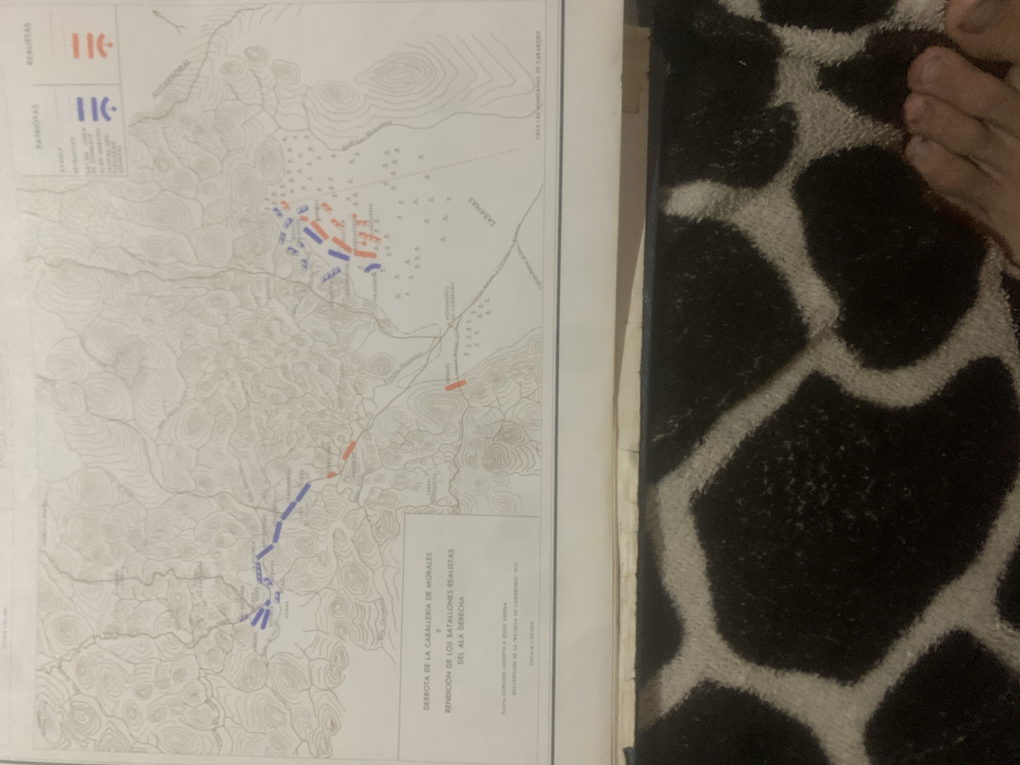
This media file contains a map depicting a historical battle. The map shows topographical features like hills and valleys, with roads and settlements indicated. Military troop movements are illustrated with colored markers: blue for "Patriotas" and red for "Realistas." The scene appears to be a battlefield, likely in a rural or semi-rural setting based on the terrain. Visible text on the map includes labels for locations such as "ALGARROBAL," "SABANAS," and "CASA LAS MANZANAS DE CARABOBO." There are also titles and descriptions, including "DERROTA DE LA CABALLERÍA DE MORALES Y RENDICIÓN DE LOS BATALLONES REALISTAS DEL ALA DERECHA," suggesting this map illustrates the defeat of Morales' cavalry and the surrender of realist battalions. The source is attributed to "CORONEL ALBERTO D JESUS VARELA" with a description of the "BATALLA DE CARABOBO 1975," and the scale is given as "ESCALA 1:20.000." The context provided indicates the location is La Tagua, Venezuela, and the event is the Battle of Carabobo. The map itself does not provide information about the time of day or weather, and there are no visible people or specific objects beyond the map elements and troop markers. The overall impression is a detailed cartographical representation of a military engagement.
Symbol
BF764
Volume
11,550
Creator
+$0.13
Revenue
+$0.16
TVL
$11.53
2
Rev Bot 🤖💰
Injected revenue 6d ago
“Revenue bonus for the last stake.”
+$0.17 USD