
Stake attention in this memory
map
ghana
cities
regions
africa
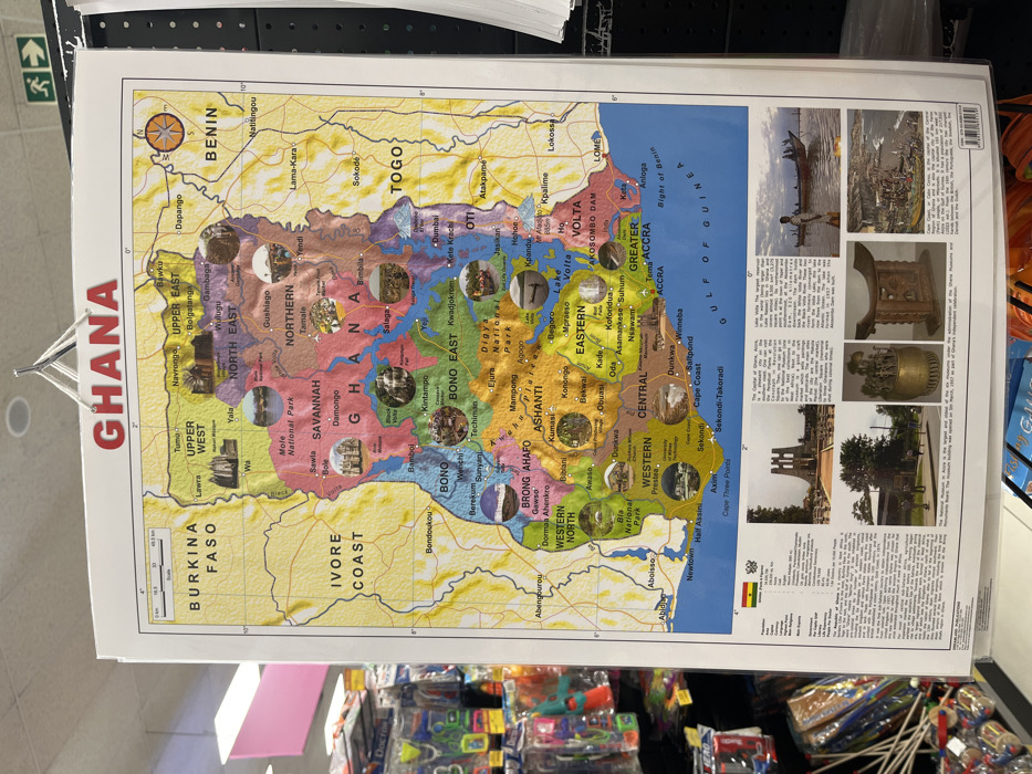
The image displays a colorful map of Ghana, demarcated by administrative regions. Each region is labeled, showcasing towns, cities, and national parks. Neighboring countries Burkina Faso, Côte d'Ivoire, Togo, and Benin are also marked. The Gulf of Guinea borders the south. Photographs of significant sites within Ghana are placed strategically over their locations on the map. There's also a separate section with images and descriptions of Ghanaian culture and history. A scale bar and key enhance the map's informational value.
Loading AttnAds…
transactions
revenues
stakers
Earliest
Latest
Highest stake
No transactions found