Stake attention in this memory
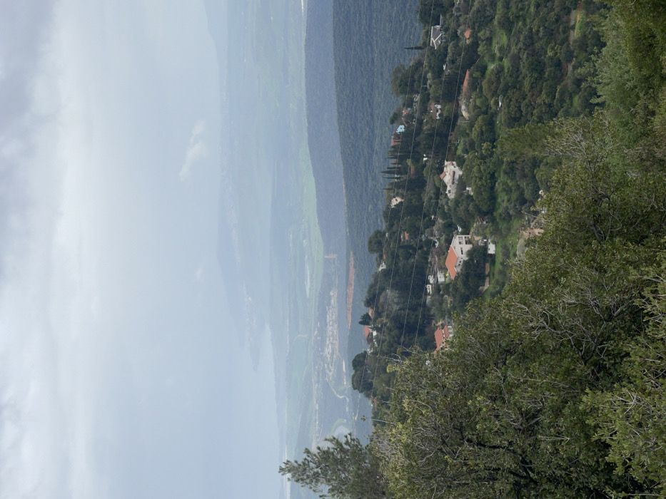
An elevated landscape photograph captures a hillside settlement situated within what appears to be the Merom HaGalil Regional Council, Israel, under a uniformly overcast sky. The immediate foreground is dominated by dense, leafy green foliage and tree branches, with a prominent conifer visible on the left. In the midground, a residential community is spread across a verdant slope, comprising multiple detached houses with light-colored facades and distinct reddish-orange tiled roofs, interspersed among a dense arrangement of green trees and shrubs. Overhead power lines are visible, horizontally traversing the settlement. Beyond the developed area, a wide valley or plain extends, revealing a winding road, cultivated green fields, and patches of reddish-brown earth. In the distant background, a large body of water, possibly a lake or sea, is discernible with a curved shoreline and faint indications of coastal development, backed by hazy mountain ranges. No individuals, specific actions, or interactions are visible.
No transactions found