Stake attention in this memory
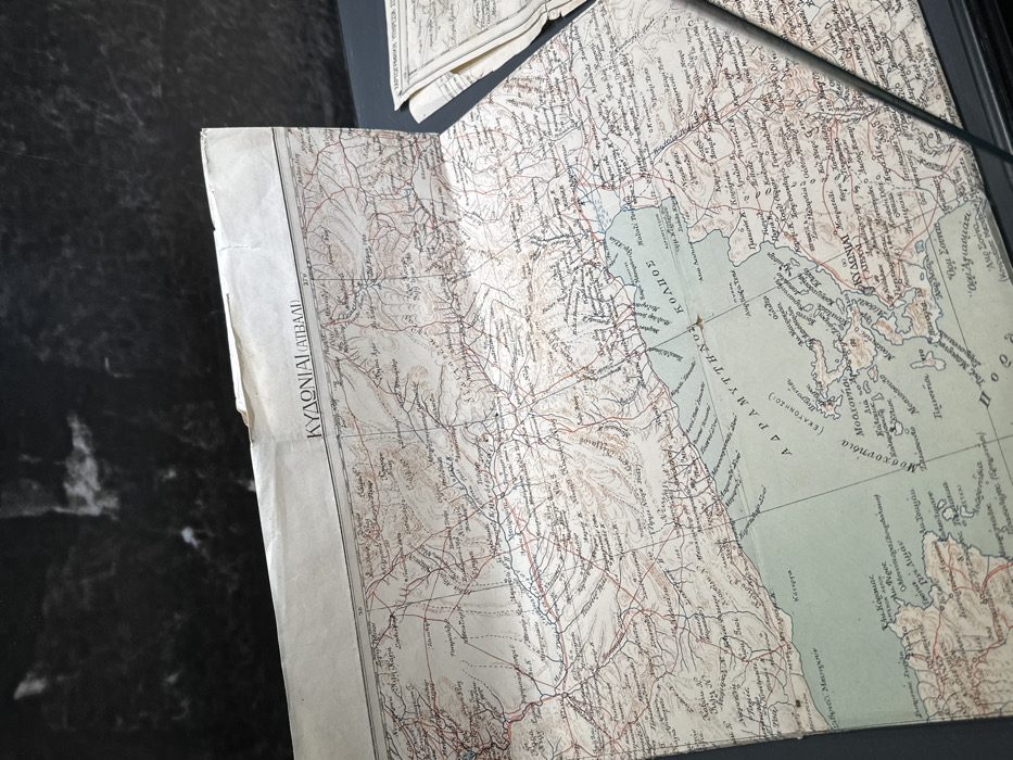
An antique, folded map is laid out on a dark, reflective surface, possibly a polished stone table. The map is angled, showing detailed cartography with contour lines, rivers, and a network of roads represented by fine red and black lines. Numerous place names are visible in Greek script across the landmasses and the sea. A prominent label on the left side reads "ΚΥΔΩΝΙΑΙ (ΑΤΒΑΛΗ)", which identifies the ancient Greek city of Kydoniai, known today as Ayvalık in Turkey. To its right, a large body of water is labeled "ΑΔΡΑΜΥΤΤΗΝΟΣ ΚΟΛΠΟΣ", translating to the Adramyttian Gulf (modern-day Gulf of Edremit). Within this gulf, an island group is marked "Μοσχονησια" (Moschonisia or Cunda Island group), with further related names like "Μοσχοφσιντο" and "(ΕΚΑΤΟΝΗΣΟΙ)". Other smaller towns and geographical features are also labeled in Greek. The map shows signs of age, including creases from folding and slight discoloration of the paper. A part of another sheet, possibly from the same map or an atlas, is visible in the upper right background. The text "ΧΑΡΤΟΓΡΑΦΙΚΗ ΥΠΗΡΕΣΙΑ ΣΤ" (Cartographic Service St...) is partially discernible at the bottom right corner of the map, indicating its origin. The image captures a static scene of this historical document.
No transactions found