Stake attention in this memory
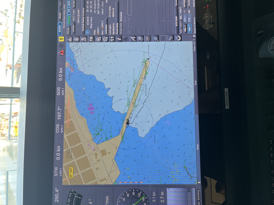
An Electronic Chart Display and Information System (ECDIS) screen, identified as a Wärtsilä Navi-Sailor 4000, is depicted, displaying a nautical chart of Ushuaia Bay, Ushuaia, Argentina. The chart identifies "PROVINCIA DE TIERRA DEL FUEGO" and "BAHIA USHUAIA." The vessel's current data indicates a heading of 290.4 degrees, a Course Over Ground (COG) of 197.7 degrees, and a Speed Over Ground (SOG) of 0.0 knots, suggesting the vessel is stationary, likely docked or anchored. The ship's symbol is positioned adjacent to what appears to be a pier, labeled "No 1" or "No 2", within the port area, with a nearby label "= Mooring Point =". A label "MODERN VENTURE" is visible near the vessel's symbol. The current GPS position is logged as 54 degrees 48.594 minutes South latitude and 068 degrees 18.065 minutes West longitude. The system time is 03:00 W, and the date is 28-01-26. The chart shows varying water depths, indicated by blue shading and numerical soundings, along with navigation aids such as green triangles. Several pink circles with crosses denote other vessels or points of interest. A magenta line indicates a planned or past route. The screen surface reflects ambient light from above, possibly from a window, showing indistinct shapes of structures beyond. Below the screen, the top edge of a dark console or keyboard with function keys (F4-F12) is partially visible. A faint, indistinct reflection of a person's head is visible in the lower central part of the screen. No other individuals are present in the image, nor are any direct actions or interactions visible.
Loading AttnAds…
No transactions found