Stake attention in this memory
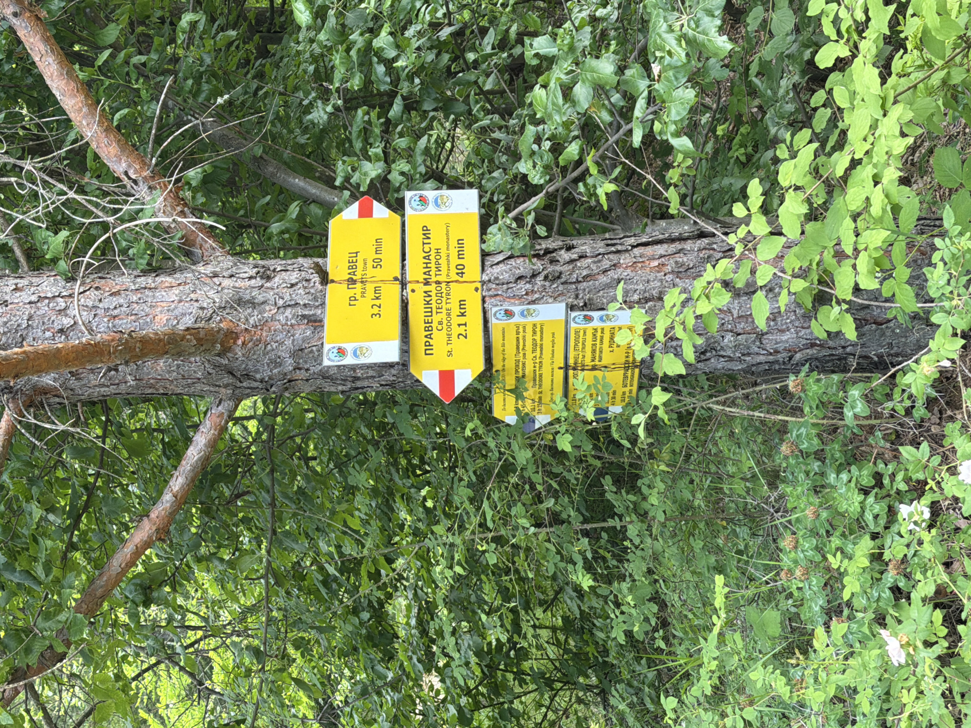
The image displays a series of yellow hiking signs attached to a thick, rough-barked tree trunk, which appears to be lying horizontally or at an angle within a dense, green forest setting. No people are visible. The signs, written in both Bulgarian Cyrillic and English, indicate directions, distances, and estimated times for various hiking destinations in the Pravets region of Bulgaria. The leftmost sign, featuring a red and white arrow pointing left, directs to "гр. ПРАВЕЦ" (Pravets town), stating it is 3.2 km away and a 50-minute walk. The sign to its right, with an arrow pointing right, leads to "ПРАВЕШКИ МАНАСТИР СВ. ТЕОДОР ТИРОН" (Praveshki monastery St. THEODORE TYRON), which is 2.1 km away and a 40-minute walk. Below the monastery sign, another, longer sign provides more detailed information for different routes, including "На билото на вр. БИЛО" (On the ridge of the Bilo mountain), "ПРАВЕШКИ ПРОХОД (Правешки връх)" (Praveshki pass (Praveshki peak)), and a longer route to the "Правешки м-р Св. ТЕОДОР ТИРОН" (Praveshki monastery St. THEODORE TYRON) estimated at 3 hours and 15 minutes, passing "Прес пр. Високата могила / Ra Visokata mogila peak". A fourth, partially visible sign to the right mentions "ХРОПНИНЕЦ (ЕТРОПОЛЕ)" (HROPINETS hut (ETROPOLE town)) at 11.8 km and 4 hours 30 minutes, along with "ВР. МАНЯКОВ КАМЪК" (VR. MANYAKOV KAMAK peak), "Х. РУДИНАТА" (H. RUDINATA), and "БОТЕВГРАДСКИ М-Р (В.)" (BOTEVGRADSKI monastery), with 15 minutes indicated for the latter. The scene suggests a well-marked hiking trail in a natural, wooded environment, likely during the daytime given the bright green foliage. The tree trunk itself is textured and appears to be pine or a similar conifer.
Symbol
C82C6
Volume
670
Creator
+$0.00
Revenue
+$0.00
TVL
$0.13
2
Rev Bot 🤖💰
Injected revenue 26d ago
“Revenue bonus for the last stake.”
+$0.00 USD