Stake attention in this memory
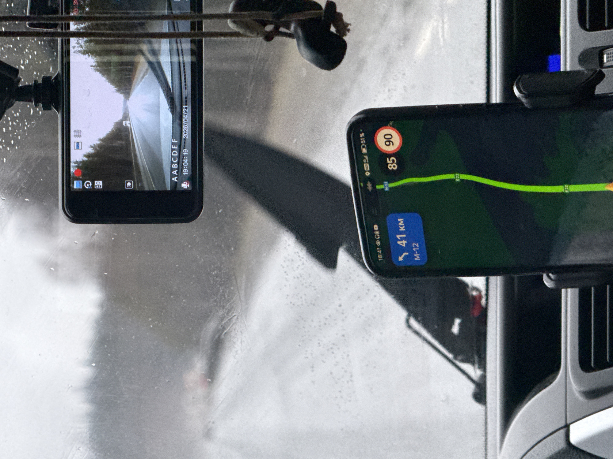
The image, taken from inside a vehicle looking through a wet windshield, depicts a journey during early evening in potentially rainy conditions. Water droplets and streaks are visible across the windshield, obscuring parts of the exterior view. Two smartphones are mounted within the vehicle. The phone on the left, likely a dashcam or acting as one, displays a live recording of a straight road flanked by trees. Its screen shows a red recording indicator, various interface icons, and overlaid text: "AABCDEF", "19:04:19", and "2026/04/21". This indicates a recording timestamp of 7:04 PM on April 21, 2026. The view through this screen suggests an overcast sky. The smartphone on the right displays a navigation application. A green route line is prominent on the map, with "E22" visible along the path. The current speed is shown as "85" (likely km/h), with a posted speed limit of "90" km/h. Below the speed information, the display indicates "41 KM" remaining and the road name "M-12". The phone's status bar shows a battery level of "51%" and the time "18:41" (6:41 PM). The scene captures a person driving on the M-12 highway in Russia, as indicated by the navigation details and the provided location context of Kiselevka, Russia. The simultaneous use of a dashcam and navigation suggests active travel.
No transactions found