Stake attention in this memory
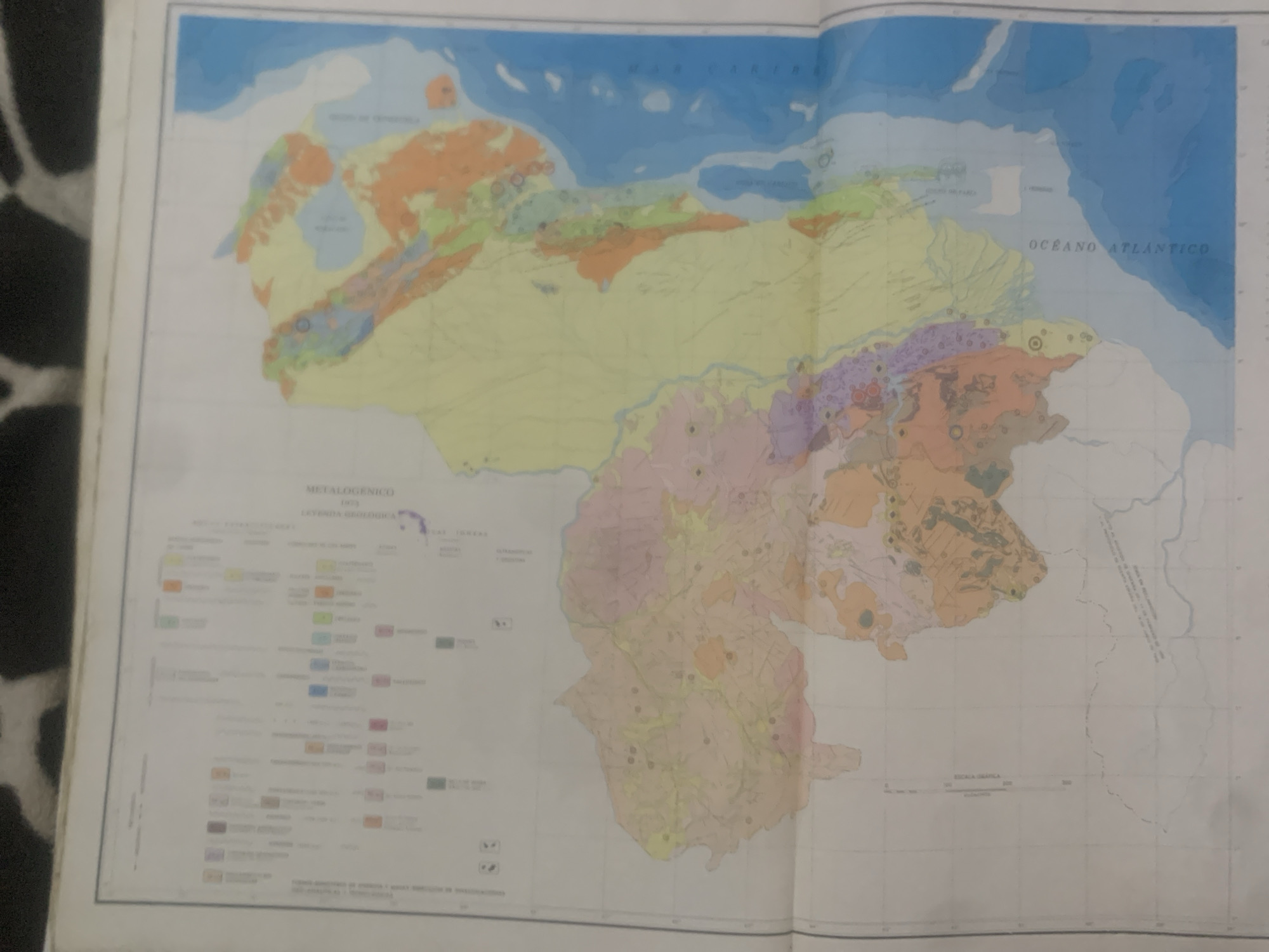
This is a photograph of an open geological and mineralogical map of Venezuela. The map displays various geological formations represented by different colors, indicating different rock types and mineral deposits. The map shows the coastline of Venezuela along the Caribbean Sea and the Atlantic Ocean, with bodies of water and land masses clearly delineated. The primary subject is the map itself, an object displaying geographical and geological information. The map is spread open, suggesting it is being studied or presented. There are no people visible in the image. Notable details include the title "METALOGENICO 1973" and "LEYENDA GEOLOGICA" (Geological Legend) on the left side, indicating the map's focus on mineral resources and its publication date. Text such as "OCEANO ATLANTICO" is also visible. The map is a detailed representation of Venezuela's topography, geological structures, and mineral occurrences. The colors on the map, such as oranges, yellows, greens, blues, and purples, represent different geological units and mineral types. The setting appears to be indoors, with the map laid out on a surface, though the surroundings are largely out of focus. The lighting appears to be even, suggesting it's not a specific time of day that is being captured. The location context is Venezuela, and a specific legend indicates the area of La Tagua, Venezuela, as part of the map's detail.
Symbol
C9FA3
Volume
0
Creator
+$0.10
Revenue
+$0.00
TVL
$0.00
2
Rev Bot 🤖💰
Injected revenue 6d ago
“Revenue bonus for the last stake.”
+$0.17 USD


