Sign in
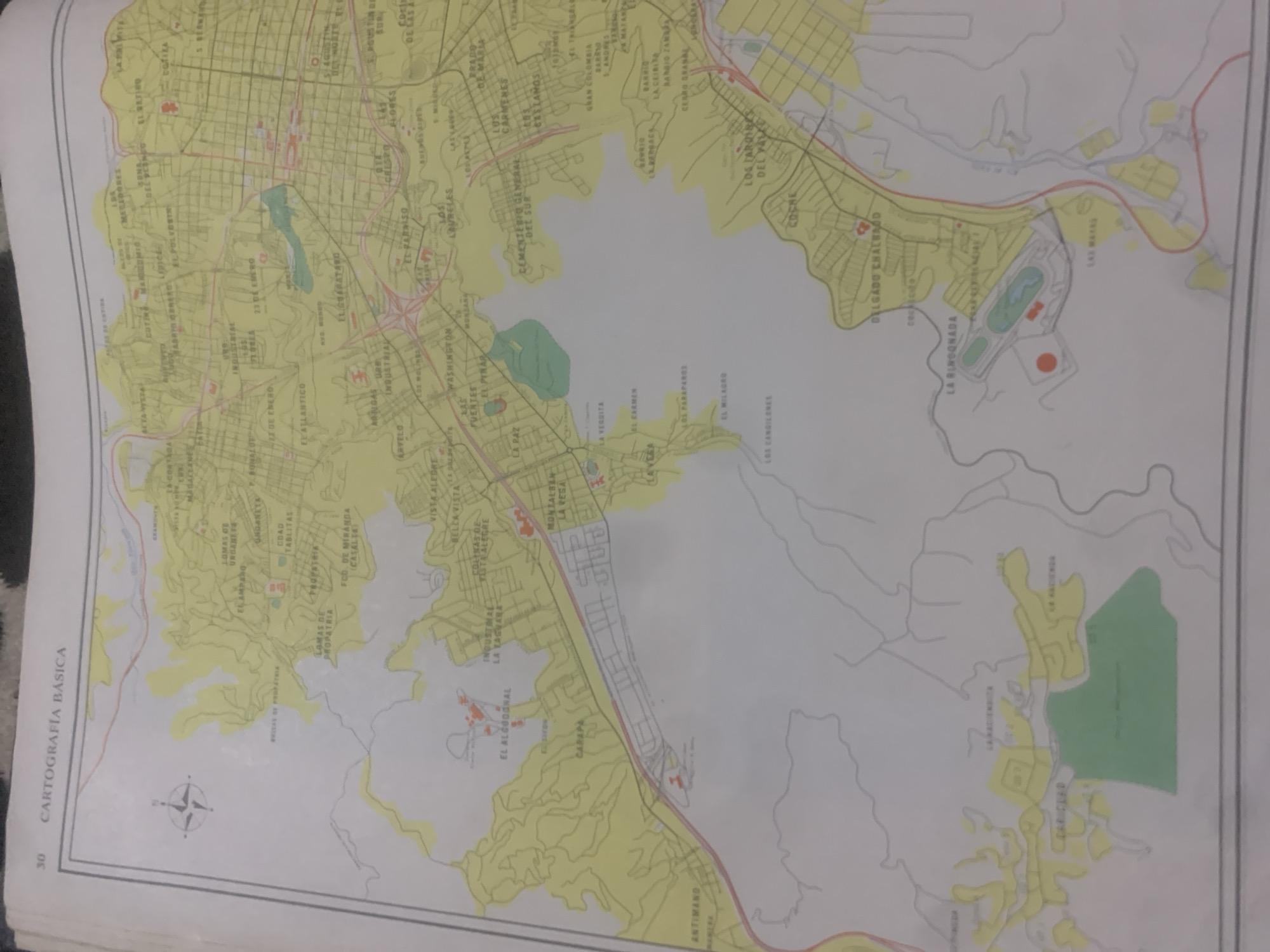
This is a color map of an urban area, likely a city, with some surrounding natural landscape. The map is oriented with the bottom edge towards the viewer, and the entire image is rotated approximately 90 degrees counter-clockwise. The majority of the map is a light yellow, indicating built-up areas or specific zones, interspersed with green areas that appear to be parks or natural reserves, and some lighter yellow areas that might represent undeveloped land or different types of zones. Several roads and street grids are visible within the yellow areas, forming distinct neighborhoods. Water features, such as rivers or streams, are depicted as thin, winding gray lines. Some red symbols are scattered across the map, possibly indicating specific points of interest or landmarks.

A prominent feature on the left side of the map is the text "CARTOGRAFÍA BÁSICA" in bold, black, vertical lettering, followed by the number "30". This indicates it is a basic cartography map from a larger collection or document. Many street names and neighborhood names are visible throughout the map in various fonts and sizes, written in Spanish. Examples include "LA PAZ," "EL CARMEN," "VISTA ALEGRE," "WASHINGTON," and "INDUSTRIA." The map appears to be a topographic or urban planning document, detailing the layout and naming conventions of different parts of the city and its surroundings. No people, specific objects, or activities are depicted; it is purely a geographical representation. The overall impression is that of a functional, informational map.
bombolico

Jun 25, 2026, 2:12 PM

La Tagua, Venezuela

Short Term

Stake attention in this memory

nostalgic
analytical
curious
pensive
detached

This is a color map of an urban area, likely a city, with some surrounding natural landscape. The map is oriented with the bottom edge towards the viewer, and the entire image is rotated approximately 90 degrees counter-clockwise. The majority of the map is a light yellow, indicating built-up areas or specific zones, interspersed with green areas that appear to be parks or natural reserves, and some lighter yellow areas that might represent undeveloped land or different types of zones. Several roads and street grids are visible within the yellow areas, forming distinct neighborhoods. Water features, such as rivers or streams, are depicted as thin, winding gray lines. Some red symbols are scattered across the map, possibly indicating specific points of interest or landmarks. A prominent feature on the left side of the map is the text "CARTOGRAFÍA BÁSICA" in bold, black, vertical lettering, followed by the number "30". This indicates it is a basic cartography map from a larger collection or document. Many street names and neighborhood names are visible throughout the map in various fonts and sizes, written in Spanish. Examples include "LA PAZ," "EL CARMEN," "VISTA ALEGRE," "WASHINGTON," and "INDUSTRIA." The map appears to be a topographic or urban planning document, detailing the layout and naming conventions of different parts of the city and its surroundings. No people, specific objects, or activities are depicted; it is purely a geographical representation. The overall impression is that of a functional, informational map.

Symbol

CA9EC

Volume

11,550

Creator

+$0.08

Revenue

+$0.11

TVL

$6.72

1D
1W
1M
All

Loading AttnAds…

transactions
revenues
stakers
Earliest
Latest
Highest stake

1

Katy

Staked 11d ago

$6.68 USD

+$0.04 USD

+0.6%

2

Rev Bot 🤖💰

Injected revenue 11d ago

Revenue bonus for the last stake.

+$0.12 USD

More from this user

More from La Tagua

bombolico

Jun 25, 2026, 2:12 PM

La Tagua, Venezuela

Licensed under Creative Commons Attribution 4.0 International License. You are free to share and adapt this content with proper attribution.





