
Sign in
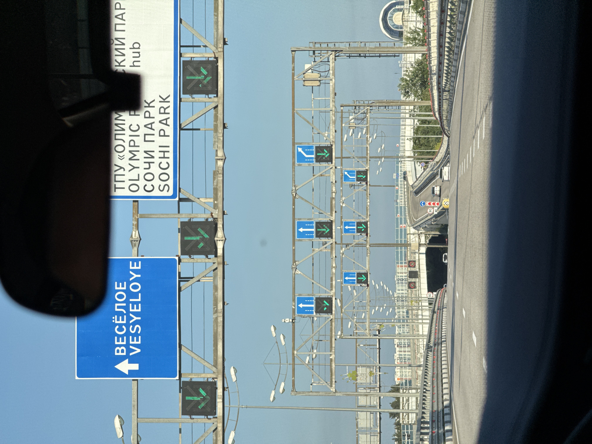
The image depicts an elevated highway in Sirius, Russia, likely leading towards or away from the Olympic Park area. Multiple overhead gantries display road signs and electronic traffic indicators.

On the left, a prominent blue rectangular sign with white text and an upward arrow indicates "ВЕСЁЛОЕ VESYELOYE". Below this sign, two green electronic indicators display downward-pointing arrows, signifying lane closures or diversions.

To the right of the "VESYELOYE" sign, a larger white sign displays text in both Russian and English. The top line reads "ТПУ «ОЛИМ" and "СКИЙ ПАР". Below this, "OLYMPIC P" and "hub" are visible. The third line shows "СОЧИ ПАРК" and the fourth line "SOCHI PARK". This sign identifies the Olympic Park Transportation Hub.

Further down the highway, additional gantries with directional signs are visible. These include blue square signs with white arrows indicating straight ahead, left turn, and right turn. Accompanying these are green electronic indicators with downward-pointing arrows, suggesting lane changes or closures.

The highway itself is paved with multiple lanes marked by white lines. Barriers line the sides of the elevated road. In the distance, modern buildings with distinctive architecture, possibly related to the Olympic Park facilities, can be seen. The sky is clear and blue. A few vehicles are present on the highway, including cars and potentially a bus, moving in the same direction as the camera's perspective. The overall scene suggests a well-developed transportation infrastructure designed to manage traffic flow in a significant urban or recreational area.
Tatiana Sek

Jun 12, 2026, 3:25 PM

Sirius, Russia

Stake attention in this memory

anticipation
journey
progress
guidance
destination

The image depicts an elevated highway in Sirius, Russia, likely leading towards or away from the Olympic Park area. Multiple overhead gantries display road signs and electronic traffic indicators. On the left, a prominent blue rectangular sign with white text and an upward arrow indicates "ВЕСЁЛОЕ VESYELOYE". Below this sign, two green electronic indicators display downward-pointing arrows, signifying lane closures or diversions. To the right of the "VESYELOYE" sign, a larger white sign displays text in both Russian and English. The top line reads "ТПУ «ОЛИМ" and "СКИЙ ПАР". Below this, "OLYMPIC P" and "hub" are visible. The third line shows "СОЧИ ПАРК" and the fourth line "SOCHI PARK". This sign identifies the Olympic Park Transportation Hub. Further down the highway, additional gantries with directional signs are visible. These include blue square signs with white arrows indicating straight ahead, left turn, and right turn. Accompanying these are green electronic indicators with downward-pointing arrows, suggesting lane changes or closures. The highway itself is paved with multiple lanes marked by white lines. Barriers line the sides of the elevated road. In the distance, modern buildings with distinctive architecture, possibly related to the Olympic Park facilities, can be seen. The sky is clear and blue. A few vehicles are present on the highway, including cars and potentially a bus, moving in the same direction as the camera's perspective. The overall scene suggests a well-developed transportation infrastructure designed to manage traffic flow in a significant urban or recreational area.

Loading AttnAds…

transactions
revenues
stakers
Earliest
Latest
Highest stake

No transactions found

More from this user

More from Sirius

Tatiana Sek

Jun 12, 2026, 3:25 PM

Sirius, Russia

Licensed under Creative Commons Attribution 4.0 International License. You are free to share and adapt this content with proper attribution.