
Sign in
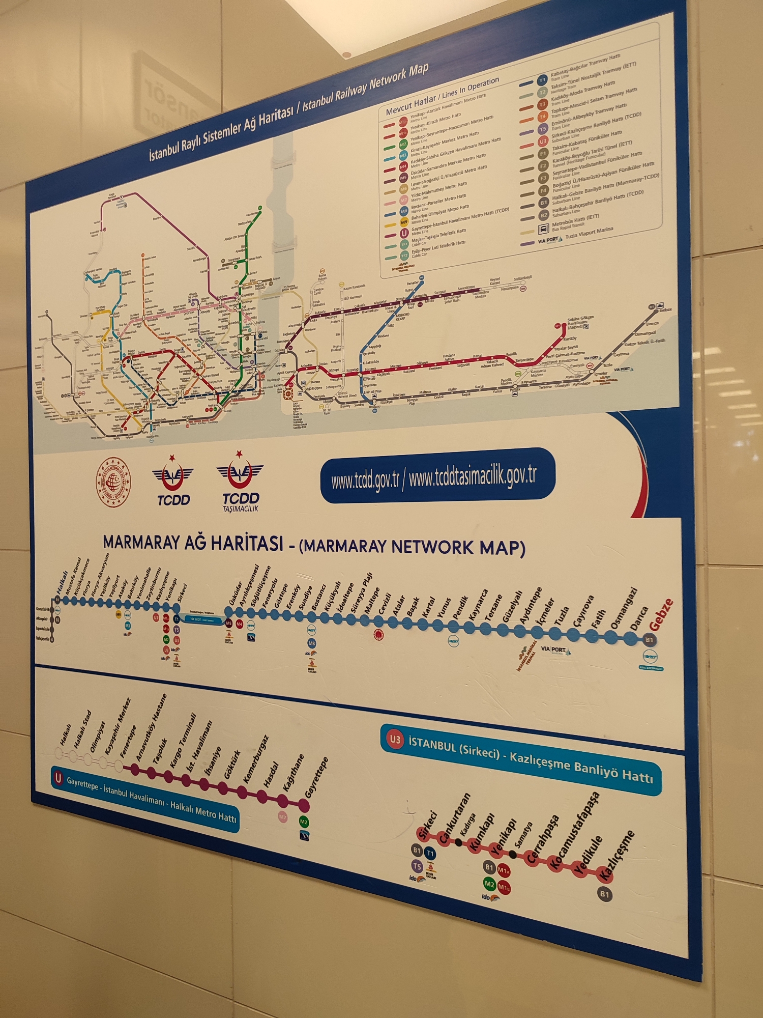
This is a photograph of a public transportation map for Istanbul, Turkey. The map is titled "İstanbul Raylı Sistemler Ağ Haritası / İstanbul Railway Network Map" and "MARMARAY AĞ HARİTASI - (MARMARAY NETWORK MAP)". It displays various metro, tram, and funicular lines across the city, color-coded and labeled with station names. The map includes logos for TCDD and TCDD Taşımacılık. There is also a website address, www.tcdd.gov.tr/www.tcddtasimacilik.gov.tr. The lower section of the map shows specific lines, including the U Garrettepe - Istanbul Havalimanı - Halkalı Metro Hattı and the U3 Istanbul (Sirkeci) - Kazlıçeşme Banliyö Hattı. There are icons representing transfer points and different modes of transport. The image is a close-up, slightly angled view of the map, which appears to be mounted on a wall. The environment suggests an indoor public space, possibly a train station or information center. The city of Maltepe, Turkey, is not explicitly mentioned or depicted as a specific location on the map, but it is a district on the Asian side of Istanbul, and some of the depicted lines likely pass through or near it, given the extent of the network shown.
Lenushka

Aug 20, 2026, 12:44 PM

Maltepe, Turkey

Short Term

Stake attention in this memory

informative
navigational
organized
complex
functional

This is a photograph of a public transportation map for Istanbul, Turkey. The map is titled "İstanbul Raylı Sistemler Ağ Haritası / İstanbul Railway Network Map" and "MARMARAY AĞ HARİTASI - (MARMARAY NETWORK MAP)". It displays various metro, tram, and funicular lines across the city, color-coded and labeled with station names. The map includes logos for TCDD and TCDD Taşımacılık. There is also a website address, www.tcdd.gov.tr/www.tcddtasimacilik.gov.tr. The lower section of the map shows specific lines, including the U Garrettepe - Istanbul Havalimanı - Halkalı Metro Hattı and the U3 Istanbul (Sirkeci) - Kazlıçeşme Banliyö Hattı. There are icons representing transfer points and different modes of transport. The image is a close-up, slightly angled view of the map, which appears to be mounted on a wall. The environment suggests an indoor public space, possibly a train station or information center. The city of Maltepe, Turkey, is not explicitly mentioned or depicted as a specific location on the map, but it is a district on the Asian side of Istanbul, and some of the depicted lines likely pass through or near it, given the extent of the network shown.

Symbol

CBA18

Volume

11,550

Creator

+$0.03

Revenue

+$0.06

TVL

$2.72

1D
1W
1M
All

Loading AttnAds…

transactions
revenues
stakers
Earliest
Latest
Highest stake

1

VR/46🏍

Staked 2d ago

$2.68 USD

+$0.03 USD

+1%

2

Rev Bot 🤖💰

Injected revenue 2d ago

Revenue bonus for the last stake.

+$0.06 USD

More from this user

More from Maltepe

Lenushka

Aug 20, 2026, 12:44 PM

Maltepe, Turkey

Licensed under Creative Commons Attribution 4.0 International License. You are free to share and adapt this content with proper attribution.