
Stake attention in this memory
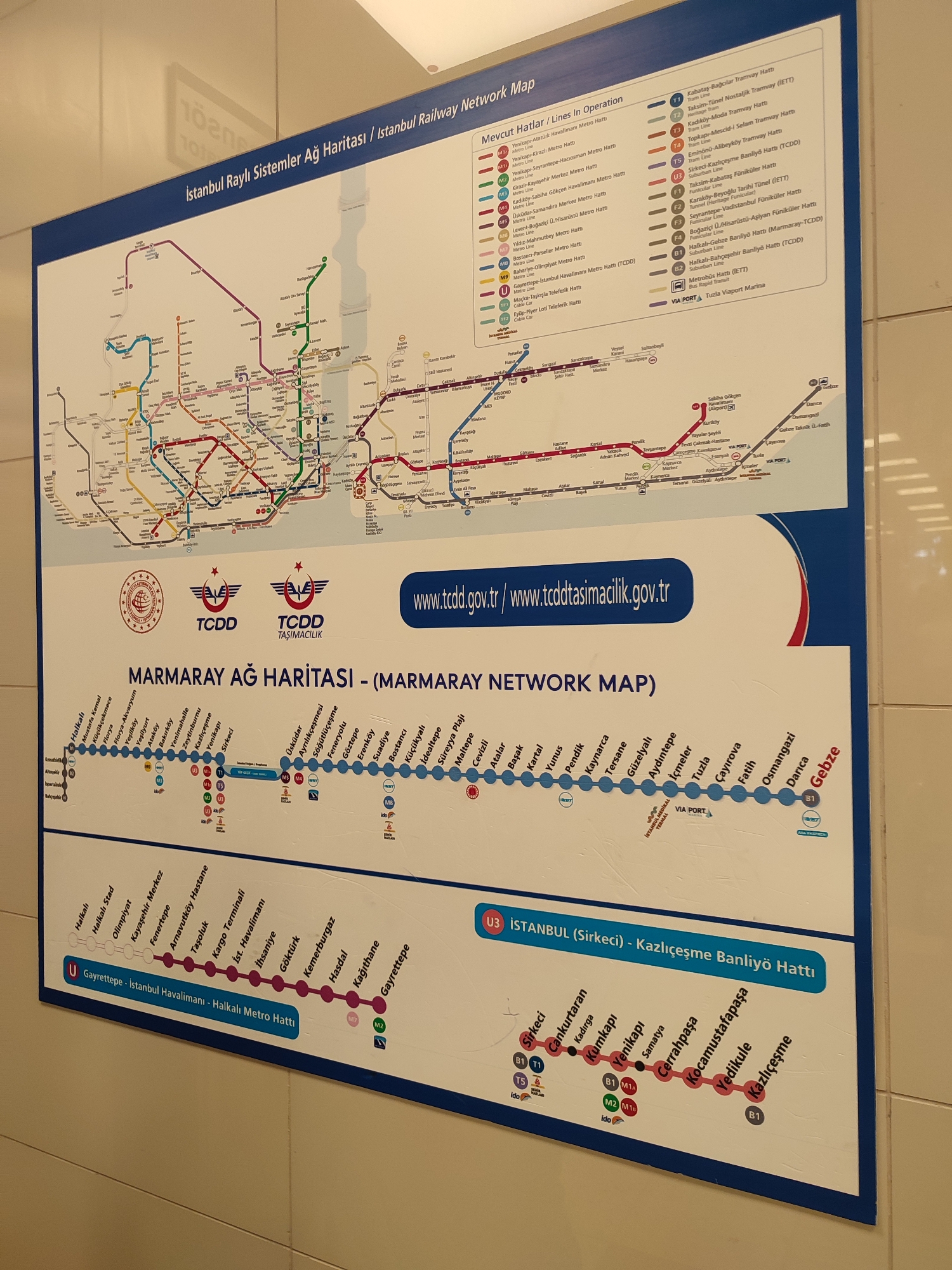
This is a photograph of a public transportation map for Istanbul, Turkey. The map is titled "İstanbul Raylı Sistemler Ağ Haritası / İstanbul Railway Network Map" and "MARMARAY AĞ HARİTASI - (MARMARAY NETWORK MAP)". It displays various metro, tram, and funicular lines across the city, color-coded and labeled with station names. The map includes logos for TCDD and TCDD Taşımacılık. There is also a website address, www.tcdd.gov.tr/www.tcddtasimacilik.gov.tr. The lower section of the map shows specific lines, including the U Garrettepe - Istanbul Havalimanı - Halkalı Metro Hattı and the U3 Istanbul (Sirkeci) - Kazlıçeşme Banliyö Hattı. There are icons representing transfer points and different modes of transport. The image is a close-up, slightly angled view of the map, which appears to be mounted on a wall. The environment suggests an indoor public space, possibly a train station or information center. The city of Maltepe, Turkey, is not explicitly mentioned or depicted as a specific location on the map, but it is a district on the Asian side of Istanbul, and some of the depicted lines likely pass through or near it, given the extent of the network shown.
Symbol
CBA18
Volume
0
Creator
+$0.03
Revenue
+$0.00
TVL
$0.00
Loading AttnAds…

2

Rev Bot 🤖💰
Injected revenue 4d ago
“Revenue bonus for the last stake.”
+$0.06 USD