Stake attention in this memory
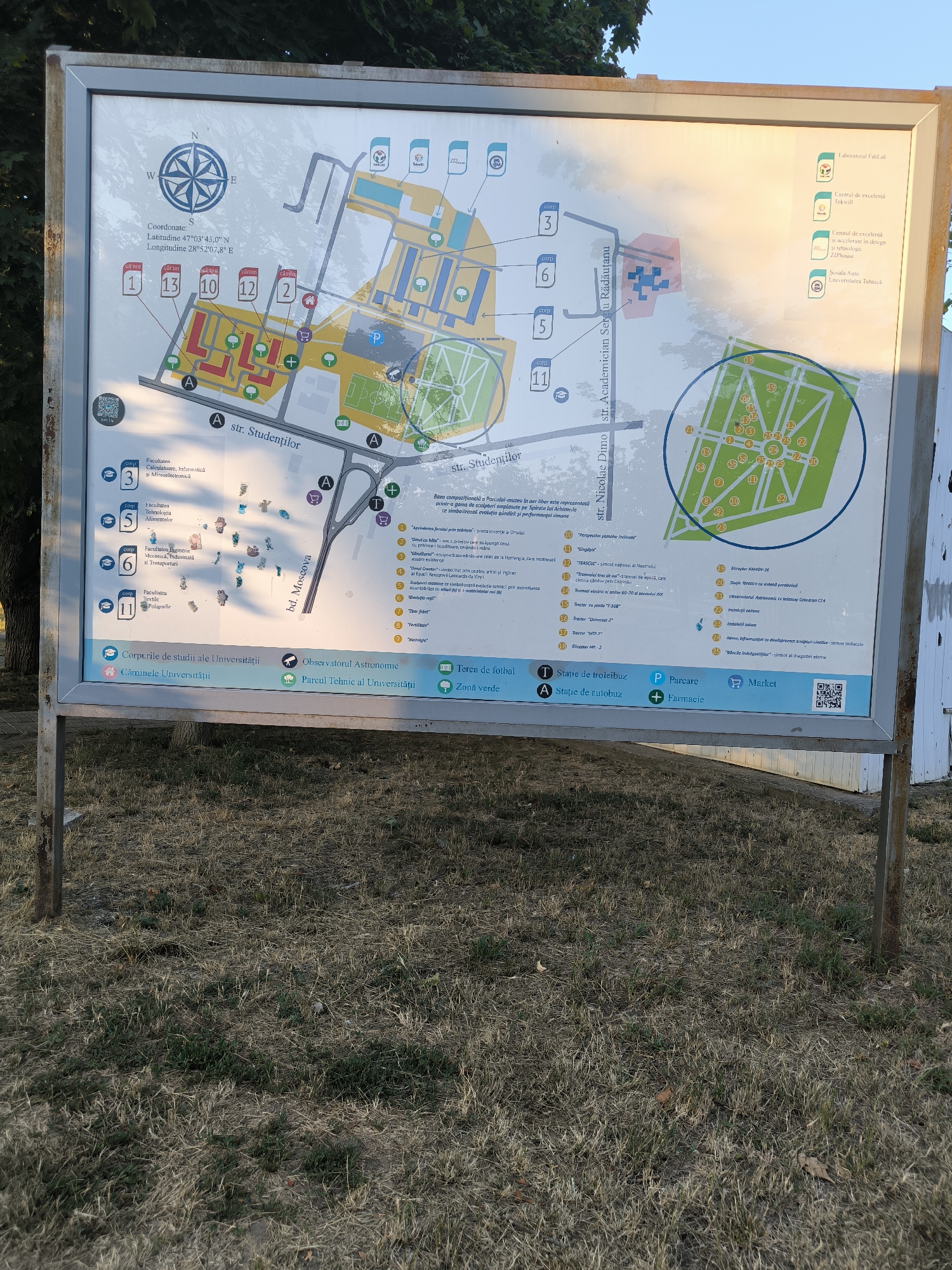
The image is a photograph of a campus map displayed on a metal stand outdoors, with dry grass and foliage in the foreground. The map is detailed, with various buildings, streets, and points of interest labeled. A compass rose indicates North, South, East, and West. Coordinates are provided as Latitude 47°03'45.0" N and Longitude 28°52'07.8" E, which places the location in Chișinău, Moldova. The map is divided into sections, with a list of faculties and buildings on the left and a larger, more detailed map of a central area on the right. The central map shows a grid-like layout of buildings, pathways, a green area with numbered circles, and a sports field. Icons represent different facilities, such as a pharmacy, parking, market, bus stop, and football field. Several buildings are labeled with numbers and names, and there are lists of faculties and their corresponding building numbers. For example, "Facultatea Calculatoare, Informatică și Microelectronică" is associated with building 3. The campus appears to be primarily academic, with "Corpuri de studii ale Universității" (University Study Buildings) and "Căminele Universității" (University Dormitories) indicated. Other labeled areas include "Observatorul Astronomic" (Astronomical Observatory) and "Parcul Tehnic al Universității" (University Technical Park). The overall scene suggests an outdoor setting on a campus, possibly on a sunny day given the lighting and shadows. The map itself is the primary subject of the photograph. There are no people visible in the image.
Loading AttnAds…
No transactions found