Stake attention in this memory
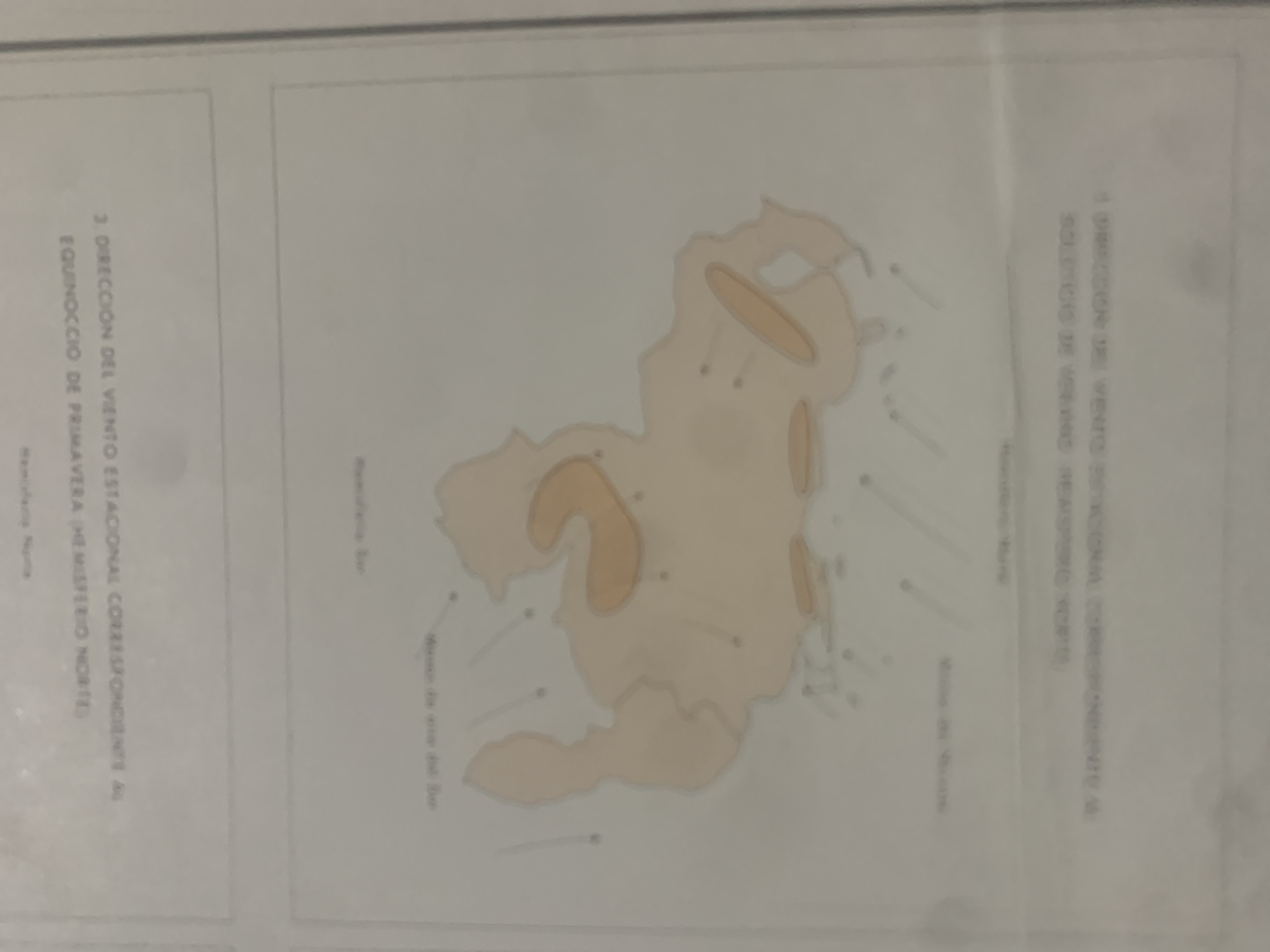
This is a tilted, medium shot of a diagram or map, likely a scientific illustration given the text and visual elements. The main subject is a light brown, irregularly shaped landmass, possibly an island or a region, depicted against a pale background. Several lighter, oval shapes are scattered across the landmass, suggesting geographical features or areas of interest. Faint lines emanate from various points on and around the landmass, resembling wind direction indicators or currents. Small dots or numbers are also present on the landmass, likely labels or data points. To the left of the landmass, there is text written vertically. It appears to be a description or title related to the diagram. The visible text reads: "3 DIRECCION DEL VIENTO ESTACIONAL CORRESPONDIENTE AL EQUINOCCIO DE PRIMAVERA (HEMISTERIO NORTE)". Below this, in smaller text, are the words "Verano Norte". To the right of the landmass, there is another block of vertical text, mirroring the style on the left. The visible text reads: "A DIRECCION DEL VIENTO ESTACIONAL CORRESPONDIENTE AL SOLSTICIO DE VERANO (HEMISTERIO NORTE)". Below this, in smaller text, are the words "Invierno Norte". Further down and to the left of the landmass, there is more text, this time more horizontal, and partially obscured. The visible portion reads "Morro de eses del Sur". Similar text appears on the right side as well, reading "Morro de Macuro". The overall impression is that of a scientific illustration detailing wind patterns or directional information for a specific geographical location, likely during different seasons (spring, summer, and winter are mentioned). The muted colors and the diagrammatic style suggest a focus on data representation rather than aesthetic appeal. No people are visible. The lighting is diffused, and there are no clear indicators of time of day or weather, other than what the diagram itself purports to represent. The location context provided is La Tagua, Venezuela.
Symbol
CC9DB
Volume
11,550
Creator
+$0.14
Revenue
+$0.19
TVL
$11.63
2
Rev Bot 🤖💰
Injected revenue 6d ago
“Revenue bonus for the last stake.”
+$0.21 USD


