
Sign in
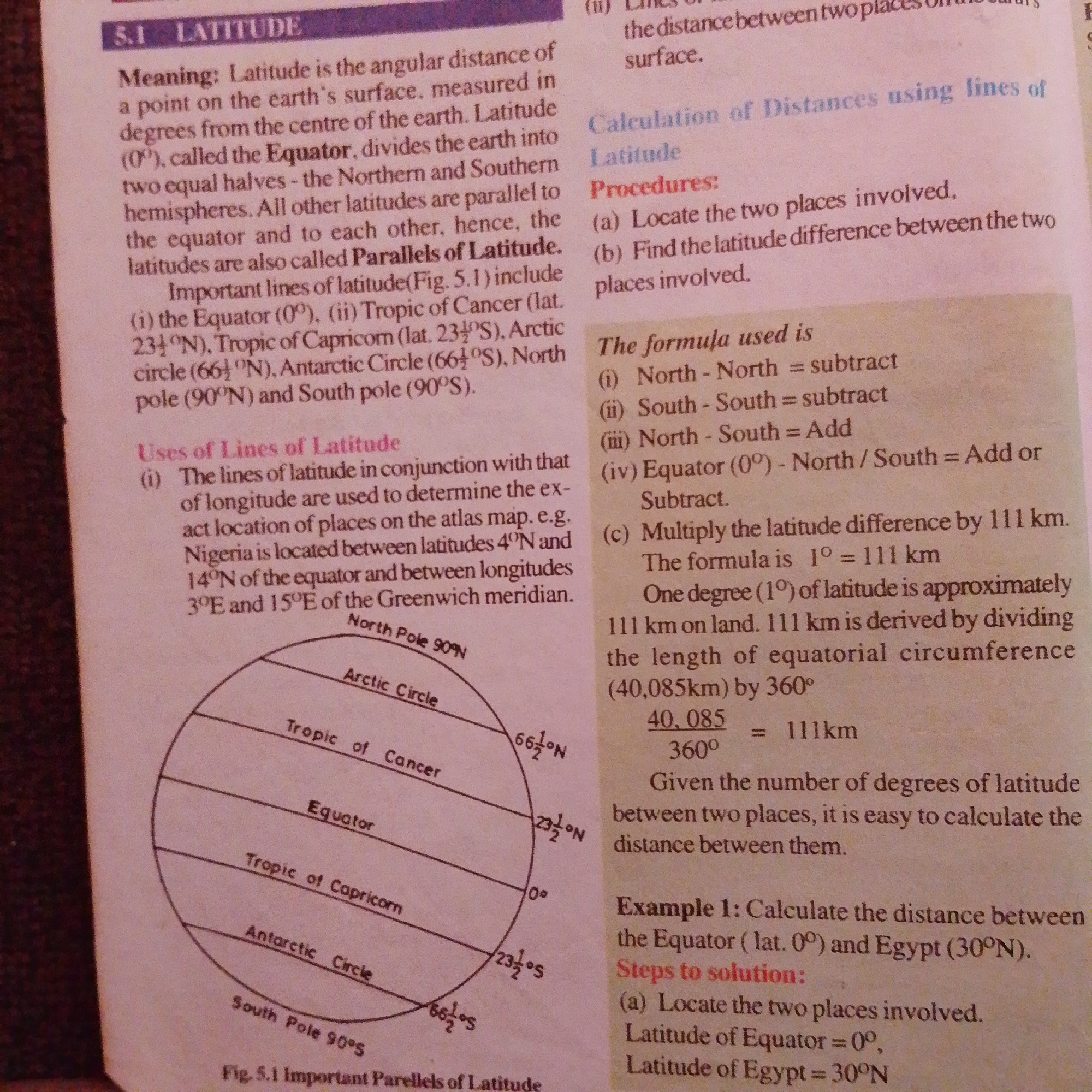
This is a close-up, top-down photograph of a page from a textbook. The page discusses latitude, its measurement, and its uses in calculating distances. The primary subject is the text itself, which is densely packed and instructional.

The text is divided into sections with headings like "LATITUDE," "Meaning," "Uses of Lines of Latitude," "Calculation of Distances using lines of Latitude," and "Example 1." There are also some visual aids, including a diagram illustrating lines of latitude on a globe, labeled with key parallels such as the Equator, Tropics of Cancer and Capricorn, Arctic Circle, Antarctic Circle, and the North and South Poles. The diagram shows numerical values for these lines in degrees North and South.

The activity taking place is learning, as the material is educational. The setting is a printed page, likely from a geography or earth science textbook. There are no people or emotions visible. The lighting appears to be typical indoor lighting, and there are no weather cues. The location context is Jalingo, Nigeria, but this information is not directly inferable from the image content itself.

Notable details include the specific degrees of latitude for various parallels (e.g., 23½°N for the Tropic of Cancer, 66½°N for the Arctic Circle, 90°N for the North Pole). The text also provides a formula for calculating distances based on latitude difference, stating that one degree of latitude is approximately 111 km. An example calculation involving Egypt is presented. The image contains a caption at the bottom: "Fig. 5.1 Important Parellels of Latitude."
FM-66btC3

Jun 30, 2026, 4:01 PM

Jalingo, Nigeria

Moment

Stake attention in this memory

studious
analytical
focused
academic
neutral

This is a close-up, top-down photograph of a page from a textbook. The page discusses latitude, its measurement, and its uses in calculating distances. The primary subject is the text itself, which is densely packed and instructional. The text is divided into sections with headings like "LATITUDE," "Meaning," "Uses of Lines of Latitude," "Calculation of Distances using lines of Latitude," and "Example 1." There are also some visual aids, including a diagram illustrating lines of latitude on a globe, labeled with key parallels such as the Equator, Tropics of Cancer and Capricorn, Arctic Circle, Antarctic Circle, and the North and South Poles. The diagram shows numerical values for these lines in degrees North and South. The activity taking place is learning, as the material is educational. The setting is a printed page, likely from a geography or earth science textbook. There are no people or emotions visible. The lighting appears to be typical indoor lighting, and there are no weather cues. The location context is Jalingo, Nigeria, but this information is not directly inferable from the image content itself. Notable details include the specific degrees of latitude for various parallels (e.g., 23½°N for the Tropic of Cancer, 66½°N for the Arctic Circle, 90°N for the North Pole). The text also provides a formula for calculating distances based on latitude difference, stating that one degree of latitude is approximately 111 km. An example calculation involving Egypt is presented. The image contains a caption at the bottom: "Fig. 5.1 Important Parellels of Latitude."

Symbol

CD395

Volume

3,225

Creator

+$0.00

Revenue

+$0.01

TVL

$0.26

1D
1W
1M
All

Loading AttnAds…

transactions
revenues
stakers
Earliest
Latest
Highest stake

1

FM-r1gUH2

Staked 1mo ago

$0.25 USD

+$0.00 USD

+1%

2

Rev Bot 🤖💰

Injected revenue 1mo ago

Revenue bonus for the last stake.

+$0.01 USD

More from this user

More from Jalingo

FM-66btC3

Jun 30, 2026, 4:01 PM

Jalingo, Nigeria

Licensed under Creative Commons Attribution 4.0 International License. You are free to share and adapt this content with proper attribution.