Stake attention in this memory
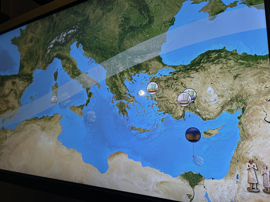
The image displays a digital map of the Mediterranean Sea and its surrounding landmasses, shown on a large screen within what appears to be a museum or exhibition space in Athina, Greece. The map features a realistic, satellite-view style for the land, showing green vegetation, brown arid regions in North Africa, and snow-capped mountains in Europe (e.g., the Alps). The sea is depicted in a uniform blue. Several graphical elements are overlaid on the map: - Three circular icons representing ancient sailing ships with red hulls and white/blue sails. One is positioned west of Greece, and two are clustered off the southwestern coast of modern-day Turkey. - Five stylized, swirling, cloud-like or vortex-like grey/purple icons. These are located in the waters west of Italy, south of Sicily, west of Greece, south of Crete, and in the eastern Mediterranean south of Turkey/Cyprus. - A large, dark blue and gold spherical icon with a red string extending downwards to a small red dot, situated in the eastern Mediterranean, south of Turkey and Cyprus. - A glowing white crescent shape is visible in the Aegean Sea, between Greece and Turkey. The screen exhibits a prominent horizontal reflection, partially obscuring the map's details, particularly across its upper-left to mid-right section. In the bottom right corner of the frame, outside the digital display, two light-colored, ancient-looking statues or figurines, possibly depicting human figures, are visible, suggesting they are part of the broader exhibit. The scene likely represents an interactive educational display illustrating historical maritime activities, mythological voyages (such as the Odyssey), or significant geographical and cultural events within the ancient Mediterranean world. No visible text is legible on the screen or the statues.
No transactions found