
Stake attention in this memory
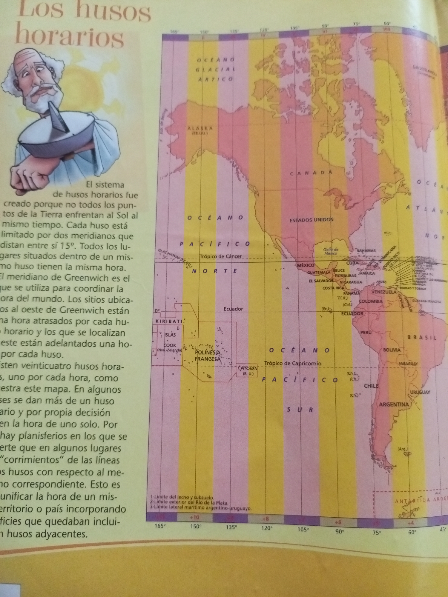
The image displays a map illustrating time zones across the globe, with a particular focus on North and South America. The title, "Los husos horarios," translates to "The time zones." An illustration of an elderly man with a white beard holding a sundial is positioned on the left side of the image. He appears to be the narrator or a symbolic representation of timekeeping. The map itself is color-coded with vertical stripes representing different time zones. Latitude and longitude lines are visible, and names of continents, oceans, countries, and significant geographical features like the Tropic of Cancer and the Tropic of Capricorn are labeled in Spanish. Some cities and regions are also marked. The text accompanying the illustration explains the concept of time zones, stating that they were created because not all parts of the Earth face the sun at the same time. Each time zone is defined by two meridians 15 degrees apart, and all locations within a time zone share the same time. The meridian of Greenwich is cited as the reference point for coordinating the time around the world. Locations west of Greenwich are one hour behind for each time zone, while those to the east are ahead. The text also mentions that there are twenty-four time zones, one for each hour, as depicted on the map. It further notes that some countries or territories may use more than one time zone or adjust their time for their own reasons, sometimes leading to "shifts" in the time zone lines relative to the corresponding meridian. Crucially, the image does **not** contain any information or visual elements that reference the city of Santa Ana, Venezuela. Therefore, it is impossible to provide a description of that specific location based on this image.
Symbol
CEFE2
Volume
11,550
Creator
+$0.10
Revenue
+$0.16
TVL
$7.97

2

Rev Bot 🤖💰
Injected revenue 11d ago
“Revenue bonus for the last stake.”
+$0.17 USD