
Sign in
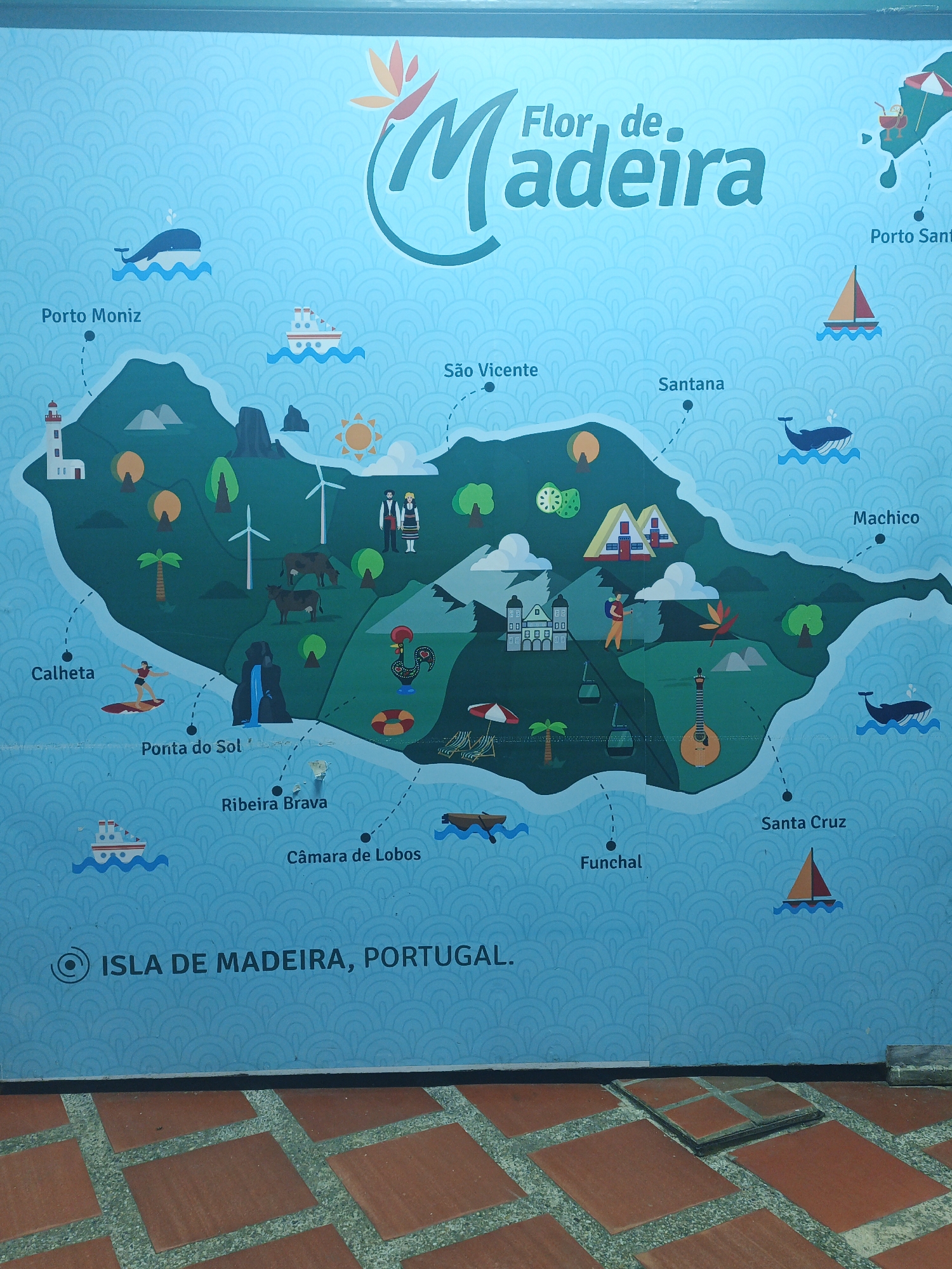
This image captures a vibrant, stylized map of Madeira Island, Portugal, displayed as a mural or large sign, set against a patterned blue background. The map, titled "Flor de Madeira" (Flower of Madeira) at the top, showcases various towns and attractions across the island.

The island outline is dark green, surrounded by blue water. Illustrated subjects on the map include whales, ships, a lighthouse, wind turbines, cows, traditional houses, waterfalls, palm trees, and various human figures engaged in activities like surfing and hiking, along with traditional dancers. Landmarks like the rooster of Barcelos, cable cars, and a guitar-like instrument are also depicted, suggesting local culture and attractions. The map points out towns such as Porto Moniz, Calheta, Ponta do Sol, São Vicente, Santana, Machico, Ribeira Brava, Santa Cruz, Câmara de Lobos, and Funchal, as well as Porto Santo.

Below the map, the ground surface is visible, covered with terracotta-colored square tiles arranged in a grid pattern, separated by darker grey strips. A small, raised square platform, also tiled, is present on the right side of the ground. The overall scene is brightly lit, implying daytime. The map's cheerful illustrations and sunny depiction evoke a positive and inviting mood, likely for tourism promotion.

Visible text on the map explicitly states "ISLA DE MADEIRA, PORTUGAL." The photograph was taken in Tinaquillo, Venezuela.
❄️BI HAN❄️

Apr 16, 2026, 10:50 PM

Tinaquillo, Venezuela

Stake attention in this memory

Joyful
Peaceful
Curious
Relaxed
Hopeful

This image captures a vibrant, stylized map of Madeira Island, Portugal, displayed as a mural or large sign, set against a patterned blue background. The map, titled "Flor de Madeira" (Flower of Madeira) at the top, showcases various towns and attractions across the island. The island outline is dark green, surrounded by blue water. Illustrated subjects on the map include whales, ships, a lighthouse, wind turbines, cows, traditional houses, waterfalls, palm trees, and various human figures engaged in activities like surfing and hiking, along with traditional dancers. Landmarks like the rooster of Barcelos, cable cars, and a guitar-like instrument are also depicted, suggesting local culture and attractions. The map points out towns such as Porto Moniz, Calheta, Ponta do Sol, São Vicente, Santana, Machico, Ribeira Brava, Santa Cruz, Câmara de Lobos, and Funchal, as well as Porto Santo. Below the map, the ground surface is visible, covered with terracotta-colored square tiles arranged in a grid pattern, separated by darker grey strips. A small, raised square platform, also tiled, is present on the right side of the ground. The overall scene is brightly lit, implying daytime. The map's cheerful illustrations and sunny depiction evoke a positive and inviting mood, likely for tourism promotion. Visible text on the map explicitly states "ISLA DE MADEIRA, PORTUGAL." The photograph was taken in Tinaquillo, Venezuela.

Loading AttnAds…

transactions
revenues
stakers
Earliest
Latest
Highest stake

No transactions found

More from this user

More from Tinaquillo

❄️BI HAN❄️

Apr 16, 2026, 10:50 PM

Tinaquillo, Venezuela

Licensed under Creative Commons Attribution 4.0 International License. You are free to share and adapt this content with proper attribution.