ADIK
Jan 17, 2026
Stake attention in this memory
metro map
public transportation
Tashkent
Uzbekistan
diagram
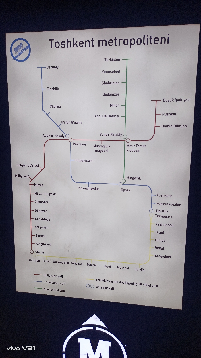
The image displays a map of the Tashkent Metro system. It features color-coded lines representing different routes: red (Chilonzor), blue (O'zbekiston), green (Yunusobod), and yellow (O'zbekiston mustaqilligining 30 yilligi yo'li). Each line includes station names in Uzbek Cyrillic. The map indicates interchange stations with circles. A logo with the letter "M" is visible at the bottom. The lines extend to various areas like Beruniy, Buyuk Ipak yo'li, and Chinor. The map is intended for commuters to navigate the Tashkent Metro.
Symbol
D2907
Volume
367
Creator
+$0.00
Revenue
+$0.00
TVL
$0.07
1D
1W
1M
All
transactions
revenues
stakers
Earliest
Latest
Highest stake
More from this user