Stake attention in this memory
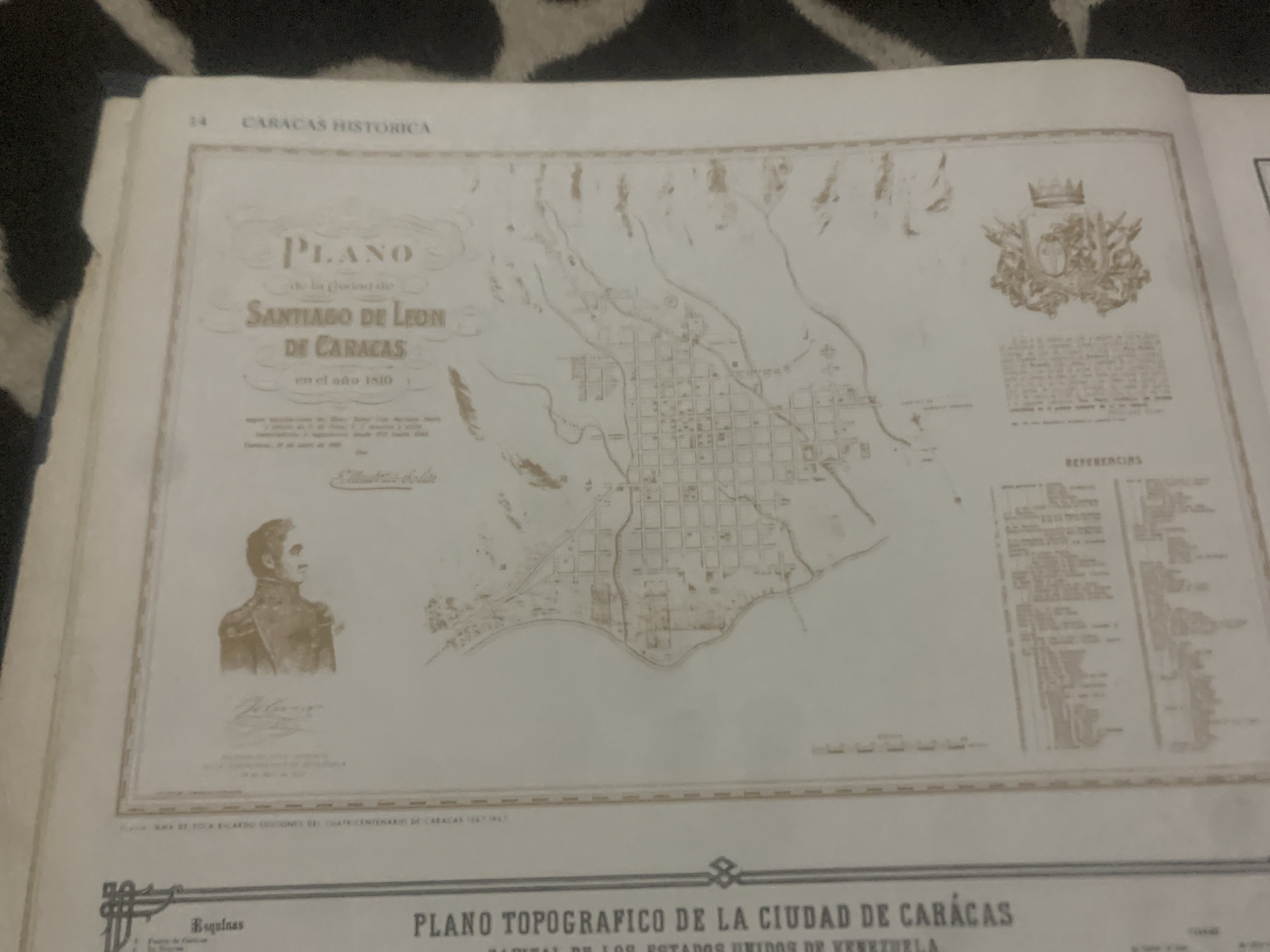
The image is a scanned historical document containing a map and text related to the city of Caracas, Venezuela. The title on the map reads "PLANO DE SANTIAGO DE LEON DE CARACAS en el año 1810", indicating it is a plan of Caracas from 1810. To the left of the map, there is text that appears to be a dedication or introduction, with the heading "Busquas". Further down on the left, larger text reads "PLANO TOPOGRAFICO DE LA CIUDAD DE CARACAS CAPITAL DE LOS ESTADOS UNIDOS DE VENEZUELA". In the upper left portion of the document, there is a small portrait of a man in profile, possibly a historical figure. Below the map, there is a section labeled "REFERENCIAS" with a list of numbered items, likely a legend or key to the map. In the lower right corner, there is an ornamental crest. The document is framed with decorative borders. The request asks for information about the location in the city of La Tagua, Venezuela. However, La Tagua is a coastal town in Aragua state, Venezuela, and is not directly related to the historical map of Caracas shown in this document. The map specifically depicts Caracas, the capital of Venezuela, and its historical context in 1810. There is no information within the provided image that pertains to La Tagua.
Symbol
D2DE0
Volume
11,550
Creator
+$0.14
Revenue
+$0.24
TVL
$11.68
2
Rev Bot 🤖💰
Injected revenue 6d ago
“Revenue bonus for the last stake.”
+$0.27 USD


