Sign in
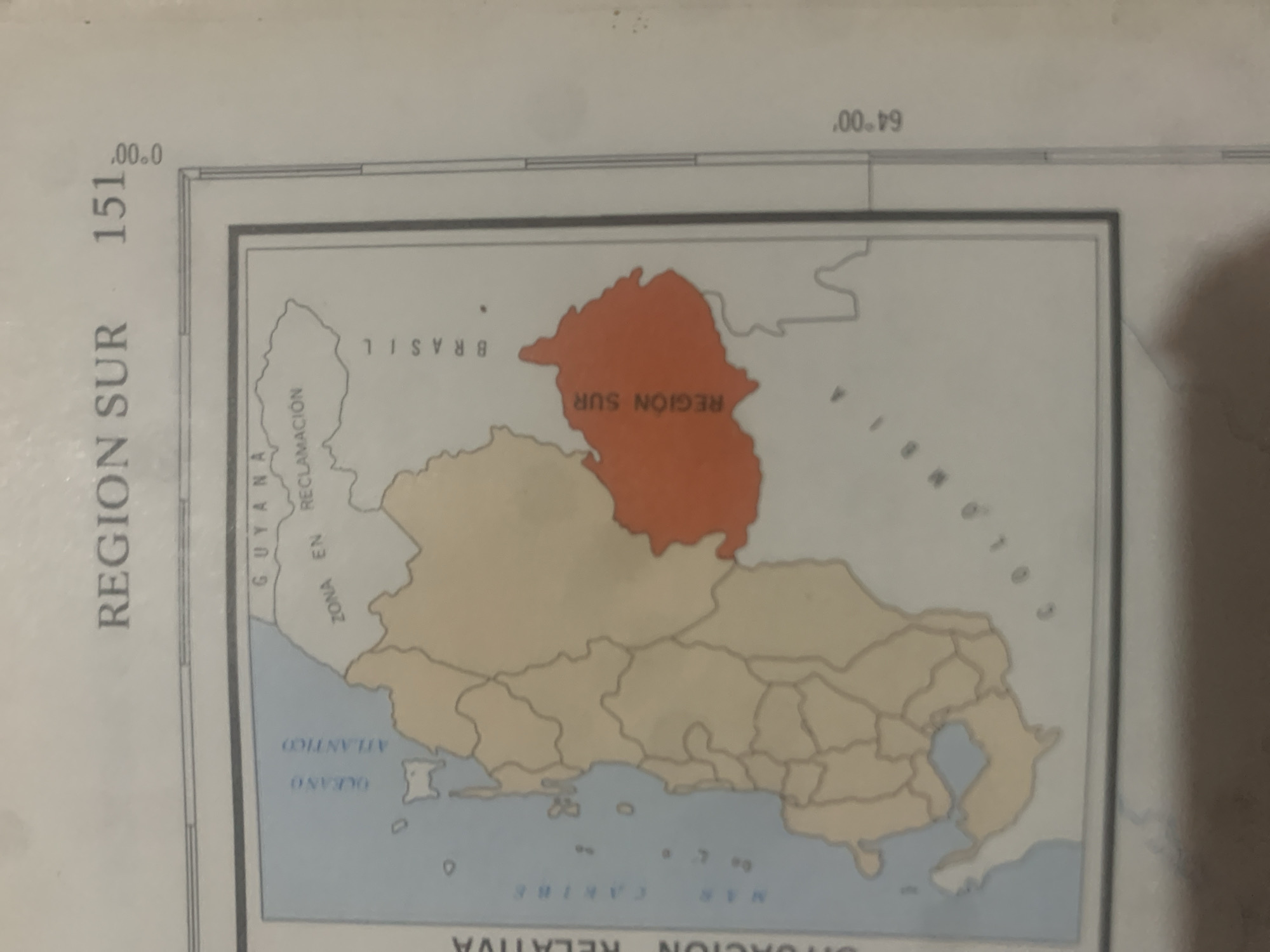
This is a cropped image of a map, likely from an atlas or textbook. The map depicts a geographical region with colored areas and labels in Spanish. The primary subject is the map itself, which appears to be a political or administrative map. The scene is an indoor setting, suggested by the lighting and the matte finish of the paper.

The map highlights "REGION SUR" which is partly colored orange and labeled "REGION SUR" within the orange area. Another area is labeled "BRASIL". There are also labels for "GUYANA", "ZONA EN RECLAMACIÓN" (Zone in Reclamation), "OCEANO ATLANTICO" (Atlantic Ocean), and "MAR CARIBE" (Caribbean Sea). Coordinate markings are visible, with "0°00′" and "64°00′" indicating longitude. The number "151" is also prominently displayed vertically along the left side of the map.

There are no people or animals visible in the image. The activity is purely informational, presenting geographical data. Notable details include the distinct coloring of the "REGION SUR" and the surrounding uncolored or lightly colored landmasses. The time of day and weather are not discernible from the image. The location cues are entirely derived from the map's content, which names specific regions and bodies of water. The overall emotion conveyed is neutral, as it is a factual representation of a map.
bombolico

Jun 25, 2026, 2:49 PM

La Tagua, Venezuela

BLOCKED

Stake attention in this memory

geographical
educational
informative
historical
neutral

This is a cropped image of a map, likely from an atlas or textbook. The map depicts a geographical region with colored areas and labels in Spanish. The primary subject is the map itself, which appears to be a political or administrative map. The scene is an indoor setting, suggested by the lighting and the matte finish of the paper. The map highlights "REGION SUR" which is partly colored orange and labeled "REGION SUR" within the orange area. Another area is labeled "BRASIL". There are also labels for "GUYANA", "ZONA EN RECLAMACIÓN" (Zone in Reclamation), "OCEANO ATLANTICO" (Atlantic Ocean), and "MAR CARIBE" (Caribbean Sea). Coordinate markings are visible, with "0°00′" and "64°00′" indicating longitude. The number "151" is also prominently displayed vertically along the left side of the map. There are no people or animals visible in the image. The activity is purely informational, presenting geographical data. Notable details include the distinct coloring of the "REGION SUR" and the surrounding uncolored or lightly colored landmasses. The time of day and weather are not discernible from the image. The location cues are entirely derived from the map's content, which names specific regions and bodies of water. The overall emotion conveyed is neutral, as it is a factual representation of a map.

Symbol

D46D8

Volume

11,550

Creator

+$0.09

Revenue

+$0.14

TVL

$7.37

1D
1W
1M
All
transactions
revenues
stakers
Earliest
Latest
Highest stake

1

RIKO

Staked 10d ago

$7.30 USD

+$0.07 USD

+1.0%

2

Rev Bot 🤖💰

Injected revenue 10d ago

Revenue bonus for the last stake.

+$0.16 USD

More from this user

More from La Tagua

bombolico

Jun 25, 2026, 2:49 PM

La Tagua, Venezuela

Licensed under Creative Commons Attribution 4.0 International License. You are free to share and adapt this content with proper attribution.