
Stake attention in this memory
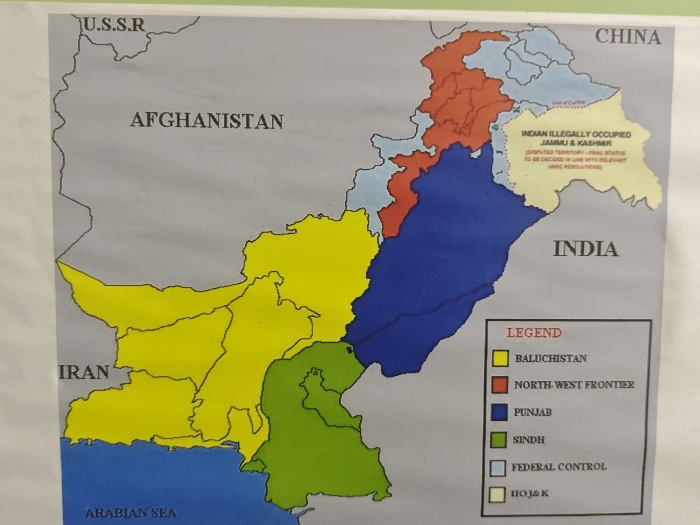
This image, located in the Chongqing High-tech Zone, China, presents a close-up view of a printed, color-coded political map primarily depicting Pakistan and its surrounding geographical region. The map is adhered to a light-colored, possibly white or off-white, vertical surface, showing minor creases and imperfections typical of a physical document. The central subject is a political map with borders outlined in black. Pakistan is divided into several provinces/territories, each designated a distinct color: Baluchistan (yellow), North-West Frontier (red), Punjab (dark blue), Sindh (green), and areas under Federal Control (light blue). A legend in the bottom right corner correlates these colors with their respective regions. Neighboring countries labeled on the map include U.S.S.R. (top left), Afghanistan (top left), Iran (middle left), China (top right), and India (right). The Arabian Sea is labeled in the bottom left. A significant portion in the northeast, bordering China and India, is labeled "INDIAN ILLEGALLY OCCUPIED JAMMU & KASHMIR," colored in a light yellow/cream tone. This area includes a visible "Line of Control" and a textual annotation stating, "(DISPUTED TERRITORY - FINAL STATUS TO BE DECIDED IN LINE WITH RELEVANT UNSC RESOLUTIONS)." No people, actions, or interactions are visible in the scene. The top edge of the image shows a slight green tint, possibly from an adjacent surface or material.
Loading AttnAds…
No transactions found