Stake attention in this memory
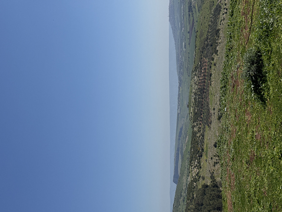
The image depicts an expansive rural landscape within the Galil Tachton Regional Council, Israel, captured from an elevated viewpoint. The upper half of the frame is dominated by a clear, bright blue sky devoid of clouds. The foreground consists of uneven terrain covered with green grass and low-lying vegetation, interspersed with patches of reddish-brown earth. A dark, thin hose or cable lies on the ground in the lower right and center. The midground features rolling hills adorned with a mix of natural greenery and cultivated areas, including what appear to be orchards or groves with regularly spaced trees. A cluster of dense, dark green trees is visible on the left side of the midground. In the background, a distinct, flat-topped geological formation or cliff face is prominent on the left. A hazy, light blue-grey band stretches across the distant horizon, suggesting either a body of water or very distant terrain. To the right of the background, a town or settlement with numerous structures is visible on a hillside, alongside cultivated fields and greenhouses in the valley below. No individuals, animals, or explicit actions are present within the scene. The environment appears serene and is illuminated by natural daylight.
Symbol
D6997
Volume
6,524
Creator
+$0.02
Revenue
+$0.00
TVL
$2.40