Stake attention in this memory
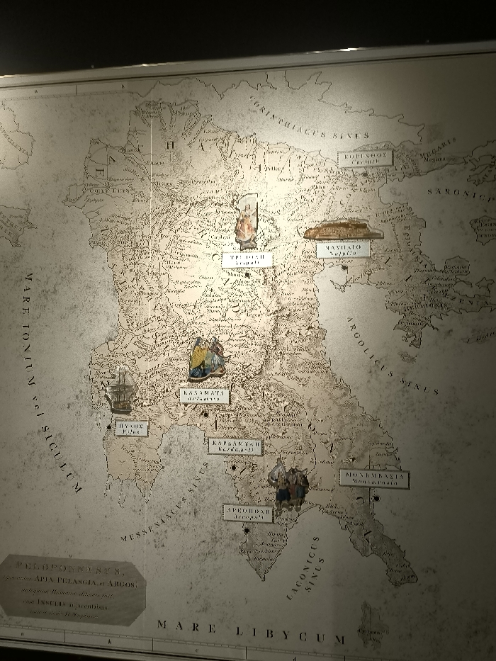
This media file captures a detailed, aged map of the Peloponnese region of Greece, displayed likely in a museum or exhibition setting in Athens. The map itself is a historical cartographic representation, showing topographical features, ancient and modern place names, and surrounding seas. Various small, three-dimensional figurines are placed on the map, illustrating specific locations. These include: * A figure, possibly an ancient deity or historical person, positioned above "ΤΡΙΠΟΛΗ Tripolitsa". * A relief of an ancient structure resembling the Parthenon or Acropolis, above "ΝΑΥΠΛΙΟ Nauplio". * A miniature sailing ship near the coast, above "ΠΥΛΟΣ Pylos". * Two figures, possibly in traditional dress, above "KAΛAMATA Kalamata". * A group of figures, possibly warriors or historical characters, above "KAPΔAMYΛH Kardamyli". * Another group of figures, above "ΑΡΕΟΠΟΛΗ Areopoli". Notable visible text on the map includes names of seas such as "MARE IONIUM vel SICULUM," "CORINTHIACUS SINUS," "SARONICUS," "ARGOLICUS SINUS," "MESSENIACUS SINUS," "LACONICUS SINUS," and "MARE LIBYCUM." A larger text box at the bottom left reads "PELOPONNESUS," followed by "APTA PELANGIA ATROS" (likely 'ARGOS') and other descriptive Latin text, providing context for the map's subject. The overall presentation is illuminated by artificial light, suggesting an indoor display, and the map's faded appearance contributes to its historical ambiance.
No transactions found