Stake attention in this memory
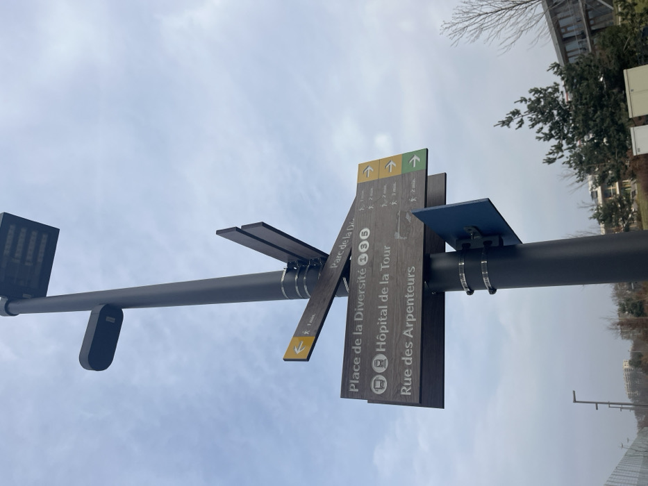
The image, taken in Meyrin, Switzerland, depicts a tall, dark gray pole standing against a cloudy, overcast sky during daytime. Attached to the pole are several wayfinding signs made of a dark, wood-like material. On the left side of the pole, a black rectangular light fixture or sensor is mounted. Further along the pole to the right, a cluster of directional signs is attached with metal clamps. These signs indicate various destinations and estimated walking times. From top to bottom (as read when upright): - A sign points with an upward arrow to "Parc de la Diversité" with an estimated walking time of "3 min." - Another sign points upward to "Place de la Diversité," showing icons for a train/metro and a bus, and an estimated walking time of "3 min." - A sign points upward to "Hôpital de la Tour," also showing icons for a train/metro and a bus, with an estimated walking time of "2 min." - A sign points upward to "Rue des Arpenteurs," with an estimated walking time of "2 min." - A separate, shorter sign piece extends to the left, pointing downwards with a yellow arrow, indicating a destination reachable in "1 min." Above the main cluster of signs, there are smaller colored panels with arrows: a green one and two yellow ones, all pointing upwards, possibly indicating general directions or additional routes. A small blue panel is also affixed to the pole above the main signs. In the background, bare tree branches and some green foliage are visible, along with a portion of a light-colored building. The original image appears to be rotated 90 degrees clockwise.
No transactions found