Sign in
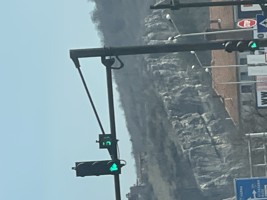
The image depicts an outdoor urban street scene in Veliko Tarnovo, Bulgaria, under a clear blue sky.

In the midground, a dark-colored overhead traffic signal gantry spans horizontally across the frame. On its left side, a vertical traffic light displays a green arrow pointing right, indicating a permitted turn. Adjacent to this light, a digital countdown timer shows "51" in green numerals. To the right, a vertical pole supports additional street lighting and a partially visible traffic light, which also appears to be green at its lowest segment. A red hexagonal "STOP" sign is affixed to a pole on the far right. In the lower left quadrant, a blue road sign with white text is partially visible, indicating directions to "VARNA" and "ST. ZAGORA" with an accompanying left-pointing arrow.

Below the traffic infrastructure, several buildings with reddish-brown tiled roofs and light-colored facades are visible, situated at the base of a prominent rocky cliff formation. The background is dominated by steep, grey rocky cliffs and hills, sparsely covered with bare deciduous trees on their upper slopes. A more distant, tree-covered hill is discernible further back. No individuals, explicit actions, or direct interactions are visible within the frame.
ISS

Mar 12, 2026, 10:15 AM

Veliko Tarnovo, Bulgaria

Moment

Stake attention in this memory

Anticipation
Urban
Serenity
Movement
Observant

The image depicts an outdoor urban street scene in Veliko Tarnovo, Bulgaria, under a clear blue sky. In the midground, a dark-colored overhead traffic signal gantry spans horizontally across the frame. On its left side, a vertical traffic light displays a green arrow pointing right, indicating a permitted turn. Adjacent to this light, a digital countdown timer shows "51" in green numerals. To the right, a vertical pole supports additional street lighting and a partially visible traffic light, which also appears to be green at its lowest segment. A red hexagonal "STOP" sign is affixed to a pole on the far right. In the lower left quadrant, a blue road sign with white text is partially visible, indicating directions to "VARNA" and "ST. ZAGORA" with an accompanying left-pointing arrow. Below the traffic infrastructure, several buildings with reddish-brown tiled roofs and light-colored facades are visible, situated at the base of a prominent rocky cliff formation. The background is dominated by steep, grey rocky cliffs and hills, sparsely covered with bare deciduous trees on their upper slopes. A more distant, tree-covered hill is discernible further back. No individuals, explicit actions, or direct interactions are visible within the frame.

Symbol

D719A

Volume

4,914

Creator

+$0.01

Revenue

+$0.00

TVL

$0.54

1D
1W
1M
All

Loading AttnAds…

transactions
revenues
stakers
Earliest
Latest
Highest stake

1

AltBot🤖

Staked 4mo ago

$0.51 USD

-$0.01 USD

-1%

2

CM🤖

Staked 4mo ago

$0.03 USD

-$0.00 USD

-1%

More from this user

More from Veliko Tarnovo

ISS

Mar 12, 2026, 10:15 AM

Veliko Tarnovo, Bulgaria

Licensed under Creative Commons Attribution 4.0 International License. You are free to share and adapt this content with proper attribution.