
Stake attention in this memory
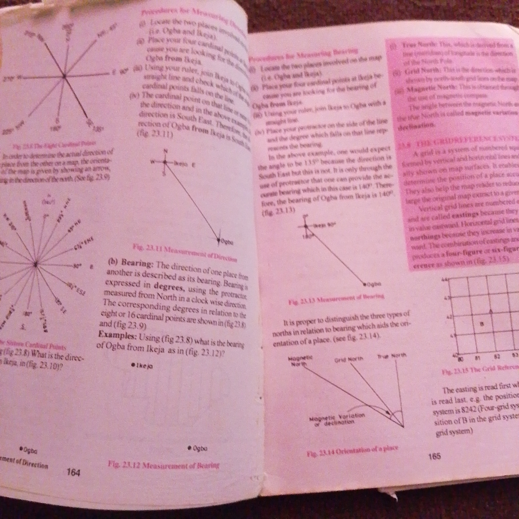
This media file is a photograph of an open textbook. The pages are pinkish and show printed text and diagrams related to geography or navigation. The left page features a diagram of a compass rose with radiating lines and degree markings, along with a section of text titled "The Sixteen Cardinal Points." Below this, there is a question about bearings and directions, referring to figures 23.8, 23.9, and 23.10. The text discusses measuring direction and bearing, using terms like "cardinal points," "degrees," "protractor," and "North." The bottom of the left page shows a diagram labeled "Fig. 23.12 Measurement of Bearing," with points labeled "Ogba" and "Ikeja." The number "164" is visible at the bottom center. The right page continues the discussion on measurement of direction and bearing, with text that includes references to "map," "ruler," and "protractor." It describes how to measure bearings and mentions specific examples like "Ogba from Ikeja." A diagram labeled "Fig. 23.13 Measurement of Bearing" is present. Further down, the text introduces "True North," "Grid North," and "Magnetic North," discussing magnetic variation or declination. This section is labeled "Fig. 23.14 Orientation of a place." A grid system is depicted in a diagram labeled "Fig. 23.15 The Grid Referen," with numbers along the axes. The text explains how to read grid references, mentioning "easting" and "northings." The number "165" is visible at the bottom right. The overall context suggests an educational setting, likely a classroom or personal study, focusing on map reading and navigation principles. The location context of Jalingo, Nigeria, would imply these are geographical concepts relevant to that region. No people or specific time of day or weather conditions are depicted.
Symbol
D939F
Volume
2,836
Creator
+$0.00
Revenue
+$0.00
TVL
$0.21
Loading AttnAds…

2

Rev Bot 🤖💰
Injected revenue 1mo ago
“Revenue bonus for the last stake.”
+$0.00 USD