
Sign in
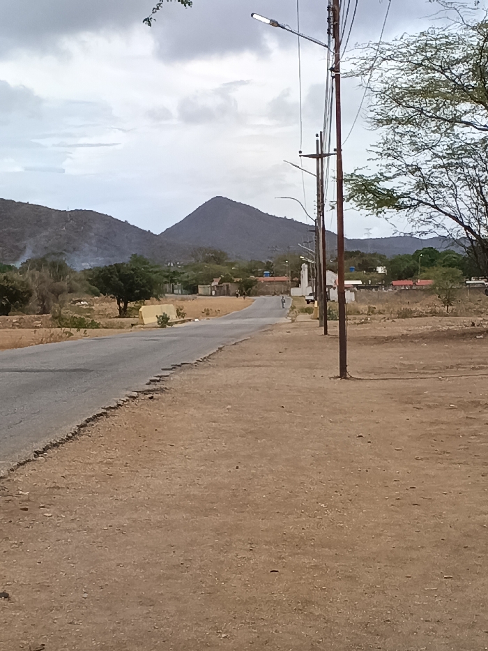
The image shows a paved road in Juangriego, Venezuela (latitude: 11.077, longitude: -63.944). The road leads towards a pair of mountains in the distance, with a line of utility poles running alongside the road. The road surface is mostly intact, although there are some cracks near the edge of the pavement on the right side. The ground on the right side of the road is dirt, dry and brown, with some sparse vegetation. The sky is overcast with gray clouds. There is a tree on the right side of the image that is partially obscured by the utility pole. There are no people visible in the image.
FM-OEpmf2

May 18, 2025, 4:59 PM

Juangriego, Venezuela

Stake attention in this memory

Tranquil
Quiet
Empty
Remote
Desolate

The image shows a paved road in Juangriego, Venezuela (latitude: 11.077, longitude: -63.944). The road leads towards a pair of mountains in the distance, with a line of utility poles running alongside the road. The road surface is mostly intact, although there are some cracks near the edge of the pavement on the right side. The ground on the right side of the road is dirt, dry and brown, with some sparse vegetation. The sky is overcast with gray clouds. There is a tree on the right side of the image that is partially obscured by the utility pole. There are no people visible in the image.

Loading AttnAds…

transactions
revenues
stakers
Earliest
Latest
Highest stake

No transactions found
More from this user

More from Juangriego

FM-OEpmf2

May 18, 2025, 4:59 PM

Juangriego, Venezuela

Licensed under Creative Commons Attribution 4.0 International License. You are free to share and adapt this content with proper attribution.