Stake attention in this memory
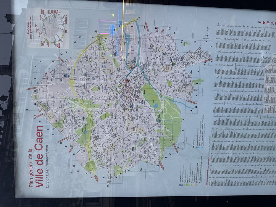
The image displays a large, vertically oriented public information map of Caen, France, presented behind a reflective glass panel. The primary subject is a detailed city map, titled "Plan général de la Ville de Caen / City of Caen general plan," occupying the left two-thirds of the display. The map is gridded for navigation, with letters A through M along the vertical axis and numbers 1 through 15 along the horizontal axis. It illustrates the urban landscape of Caen, including a dense network of streets, building blocks, green spaces (parks and gardens), and the distinctive winding path of the Orne river and canals that dissect the city. A red dot near the center of the map likely indicates the city center or a prominent landmark. In the upper left corner, a smaller inset map, labeled "Plan d'accès et les quartiers de Caen / Access map and Caen's districts," provides a broader context of the city's access points and surrounding neighborhoods. To the right of the main map, a comprehensive list of street names and principal locations, headed "Liste des rues et des lieux principaux," is organized in multiple columns, though individual entries are largely unreadable due to resolution and reflections. A partial legend is visible at the bottom of the map, detailing symbols for "HÔTEL de ville / City Hall," "Office de tourisme / Tourist Office," "Espace vert / Green space," "Cimetière / Cemetery," and various parking options ("Parking de surface payant / Open-air paid parking," "Parking souterrain payant - Utilisable pour les vélos / Underground paid parking - Usable for bikes"). Other visible text includes "FR" in the top right corner. The entire display is affected by significant glare and reflections, indicating it is likely outdoors during daylight hours. Bright light sources are reflected prominently in the upper right quadrant, obscuring portions of the map and text. No people or specific events are depicted; the display serves as a static informational guide for visitors or residents.
No transactions found