Stake attention in this memory
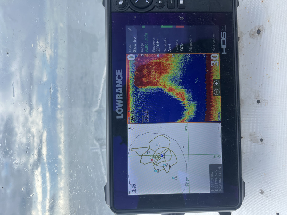
The image displays a Lowrance HDS9 marine electronics unit mounted on a white, textured boat deck, which shows minor dirt and wear. The unit's screen is active, split into two primary views. On the left, a chartplotter shows a detailed, spiraling track line indicating the boat's movement, surrounded by multiple numbered waypoints (137, 140, 142, 149, 150, 151) and one specifically labeled "BAIT." Depth contours are visible, with a marked depth of 1.5. The bottom left corner displays the current GPS coordinates: S 34°13.962', E 151°04.575', which corresponds to an offshore location near Lilyvale, Australia. The right side of the screen presents a sonar view, characterized by a large, dense, red, yellow, and green arch formation, indicating a significant concentration of marine life or underwater structure. Depth readings range from 0 to 30 feet, with prominent returns around 5 to 25 feet. Visible sonar settings include "Mode: Slow troll," "Range: Auto: 30fa," "Frequency: 200KHz," "Sensitivity: A++4," and "Colorline: 72%." The background, viewed through a wet, possibly rain-splashed window, reveals an overcast sky above a choppy, grey body of water. No individuals are present in the scene.
No transactions found