Stake attention in this memory
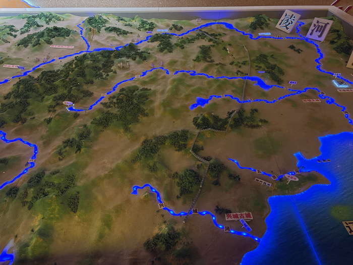
This image displays a detailed, illuminated 3D topographical relief map, depicting a geographical area within China that includes the region of Guta, Jinzhou, Liaoning Province. The map features varied terrain, with raised green sections representing forests or mountains, and flatter brown-tan areas indicating open land. A comprehensive network of rivers and a significant coastal body of water are prominently outlined by embedded bright blue LED lights. Multiple white rectangular labels with Chinese characters identify key geographical features; examples include '凌河' (Ling River), '兴城古城' (Xingcheng Ancient City), and a large water body designated by '辽' (likely Liaodong Bay or Liaoning). A distinct, winding grey linear structure, consistent with a defensive wall, traverses portions of the modeled landscape. The entire map is contained within a light-colored display frame. No human presence is observed in the scene. The map's primary action is static visual presentation through illumination for informational purposes.
Symbol
DD7CB
Volume
5,100
Creator
+$0.02
Revenue
+$0.00
TVL
$2.18