Stake attention in this memory
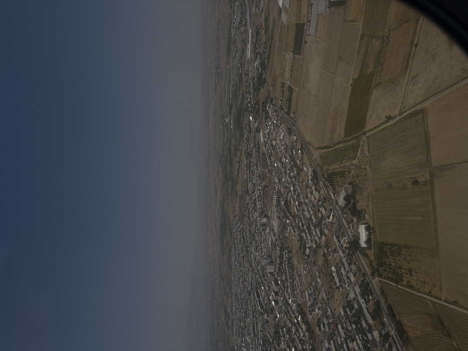
An aerial photograph captures a wide view of Vagharshapat, Armenia, and its adjacent rural landscape under a clear, hazy sky. The upper third of the image is dominated by a solid deep blue sky that transitions to a lighter, desaturated blue-gray towards the horizon, where distant, indistinct landforms are visible. The central and left portions of the frame display the urban sprawl of Vagharshapat, characterized by a high density of low-rise structures with occasional taller buildings. A prominent road or highway serves as a boundary between the urban area and the extensive agricultural fields that stretch across the right and lower sections of the image. These fields are subdivided into numerous rectangular and irregularly shaped plots, exhibiting varied conditions from fallow, dry earth to cultivated areas with visible rows of crops or organized tree plantations. A large, light-colored building with a distinctive roof is visible in the lower central part of the image, situated within the agricultural zone. The lower right corner of the frame is partially obstructed by a dark, curved object, consistent with an aircraft window frame. No individuals are discernible.
No transactions found