Sign in
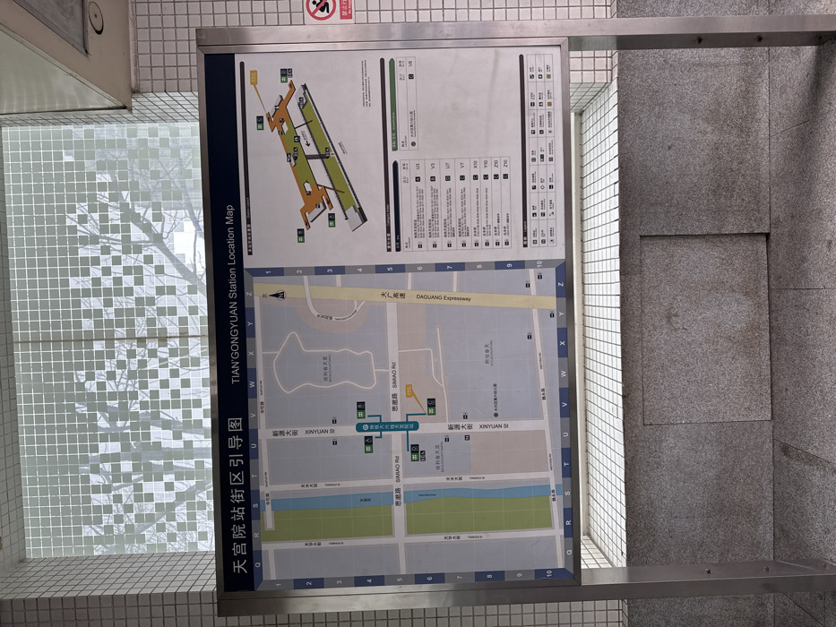
This image captures a large, vertically oriented information board displaying a "TIAN'GONGYUAN Station Location Map" (天宫院站街区引导图) inside what appears to be a subway or train station in Beijing, China. The board is mounted on a tiled wall, with part of a patterned glass window reflecting a tree visible on the left, suggesting it's daytime, possibly overcast, and there's natural light filtering in.

The information board is divided into two main sections. The upper section presents a diagram of the station's internal layout, including platforms, multiple exits (labeled with letters and numbers like C, D), and connections. The lower, larger section is a street map of the surrounding area, showing roads, buildings, and green spaces. Key roads visible include "新源大街 XINYUAN SI," "思路 SIMIAO Rd," and "大广高速 DAGUANG Expressway." The map also features grid coordinates (e.g., U, V, W, X, Y, Z horizontally, and 1-10 vertically).

On the right side of the upper section, there are lists detailing bus routes and points of interest associated with specific exits, with text like V3, V5, V7, U7, X10, Z10, 210, and V6. A small, partially visible red "no smoking" sign is adhered to the wall above the board on the far right. The overall scene is clean and utilitarian, typical of public transit environments.
Laurent

Jan 31, 2025, 5:23 AM

Beijing, China

Stake attention in this memory

This image captures a large, vertically oriented information board displaying a "TIAN'GONGYUAN Station Location Map" (天宫院站街区引导图) inside what appears to be a subway or train station in Beijing, China. The board is mounted on a tiled wall, with part of a patterned glass window reflecting a tree visible on the left, suggesting it's daytime, possibly overcast, and there's natural light filtering in. The information board is divided into two main sections. The upper section presents a diagram of the station's internal layout, including platforms, multiple exits (labeled with letters and numbers like C, D), and connections. The lower, larger section is a street map of the surrounding area, showing roads, buildings, and green spaces. Key roads visible include "新源大街 XINYUAN SI," "思路 SIMIAO Rd," and "大广高速 DAGUANG Expressway." The map also features grid coordinates (e.g., U, V, W, X, Y, Z horizontally, and 1-10 vertically). On the right side of the upper section, there are lists detailing bus routes and points of interest associated with specific exits, with text like V3, V5, V7, U7, X10, Z10, 210, and V6. A small, partially visible red "no smoking" sign is adhered to the wall above the board on the far right. The overall scene is clean and utilitarian, typical of public transit environments.

Loading AttnAds…

transactions
revenues
stakers
Earliest
Latest
Highest stake

No transactions found

More from this user

More from Beijing

Laurent

Jan 31, 2025, 5:23 AM

Beijing, China

Licensed under Creative Commons Attribution 4.0 International License. You are free to share and adapt this content with proper attribution.