Stake attention in this memory
anticipation
journey
navigation
planning
efficiency
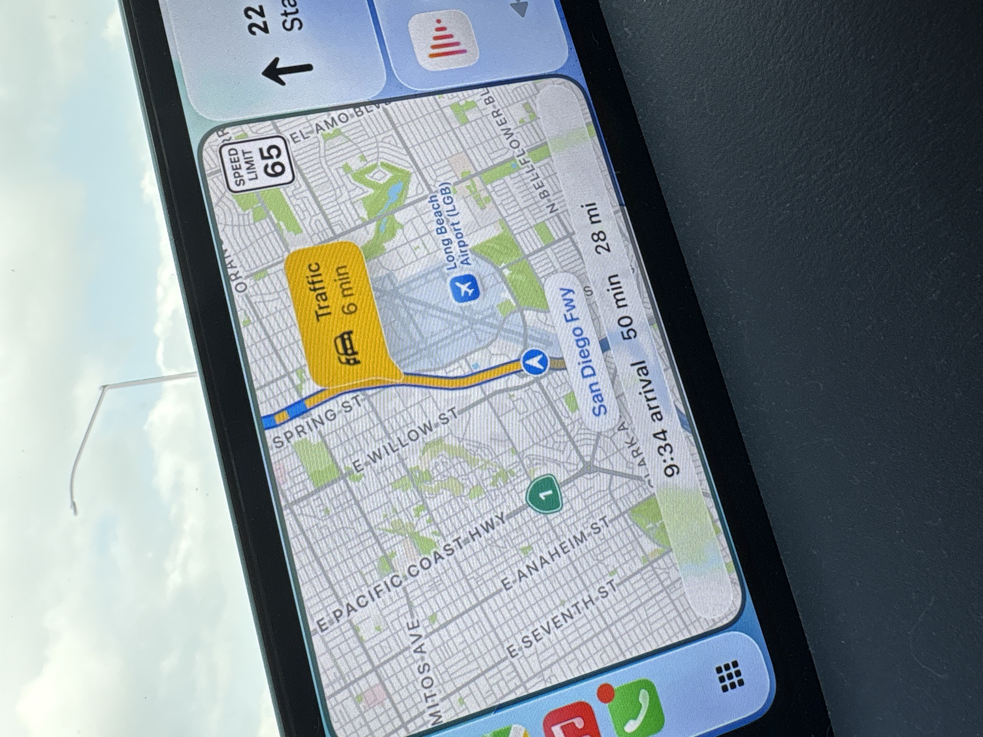
The image shows a map on a smartphone display, displaying navigation information in the city of Long Beach, United States. The map indicates "Traffic 6 min" on a section of a road near Spring Street, which runs to the North of Long Beach Airport. The airport itself is marked with a blue airplane icon. The route is also indicated on the San Diego Freeway. The speed limit is 65. The time of arrival is 9:34, with a remaining drive time of 50 minutes for 28 miles. Roads like E Pacific Coast Highway, E Anaheim St, and E Seventh St are also labeled on the map. The background suggests the photo was taken inside a vehicle.
transactions
revenues
stakers
Earliest
Latest
Highest stake
No transactions found