Stake attention in this memory
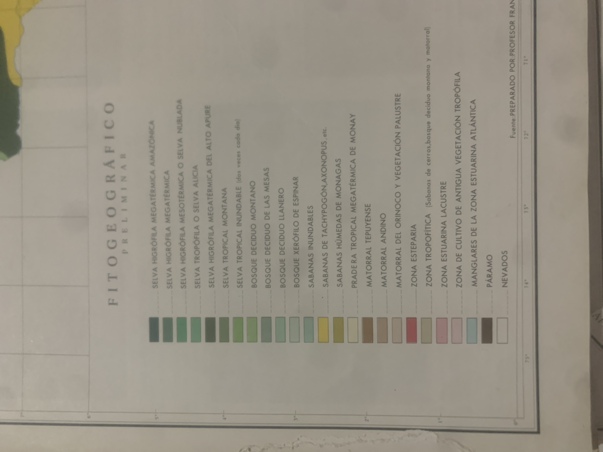
This is an image of a map or chart with a legend. The primary subject is the legend itself, which lists various types of vegetation and ecological zones, identified by text in Spanish. These include "SELVA HIGRÓFILA MEGATÉRMICA AMAZONICA," "BOSQUE DECIDUO MOΝΤΑΝΟ," "SABANAS INUNDABLES," "PRADERA TROPICAL MEGATÉRMICA DE MONAY," "ZONA ESTEPARIA," "MANGLARES DE LA ZONA ESTUARINA ATLÁNTICA," "PÁRAMO," and "NEVADOS." Each vegetation type is associated with a colored bar, suggesting a color-coding system for mapping these zones. Visible text also includes "FITOGEOGRÁFICO PRELIMINAR" at the top, indicating the chart's purpose. Along the bottom, there are numerical labels with degree symbols (e.g., "73°", "74°", "75°", "71°", "72°"), likely representing geographical coordinates like longitude. A prominent line of text at the bottom right reads "Fuente: PREPARADO POR:PROFESOR FRAN," identifying the source and creator of the document. The scene appears to be an indoor setting, with the chart presented flat, possibly on a table or wall, viewed from a slightly elevated angle. There are no people or animals visible, and the focus is entirely on the informational content of the chart. The lighting suggests it might be daytime, possibly with artificial light. The context provided (La Tagua, Venezuela) suggests the map pertains to the vegetation of that region.
Symbol
DE5A4
Volume
0
Creator
+$0.14
Revenue
+$0.00
TVL
$0.00
2
Rev Bot 🤖💰
Injected revenue 6d ago
“Revenue bonus for the last stake.”
+$0.23 USD


