Stake attention in this memory
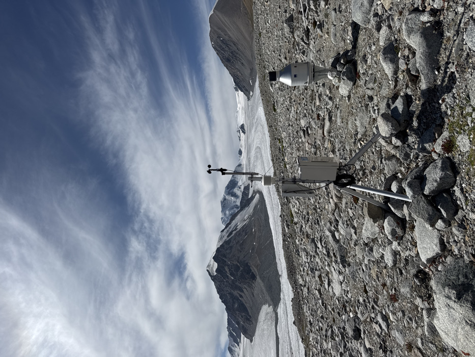
The image depicts a remote, high-altitude glaciated mountainous region within Mongolia. The foreground consists of rugged, rocky terrain with scattered boulders and sparse, low-lying vegetation. Two scientific instruments are prominently positioned. On the left, a meteorological station is mounted on a grey tripod, with its feet stabilized by surrounding rocks. This station includes a vertical mast topped with an anemometer (wind speed and direction sensor) and a white cylindrical sensor, likely for temperature and humidity. A rectangular control box or data logger is attached to the mast, with visible cabling. To the right, a smaller, silver-colored cylindrical instrument with a black cap is independently positioned on a small cairn of rocks, potentially a snow depth sensor or precipitation gauge. In the midground and background, a large, winding valley glacier is visible, flanked by steep, snow-capped and barren rocky peaks. The sky overhead is partially clear blue with scattered wispy white clouds. No individuals, vehicles, or other man-made structures are present in the scene.
Symbol
DEB6B
Volume
8,433
Creator
+$6.15
Revenue
+$1.77
TVL
$35.61
5
Collective Memory
Injected revenue 11mo ago
“Today's memory of the day! ”
+$35.65 USD
More from this user