Stake attention in this memory
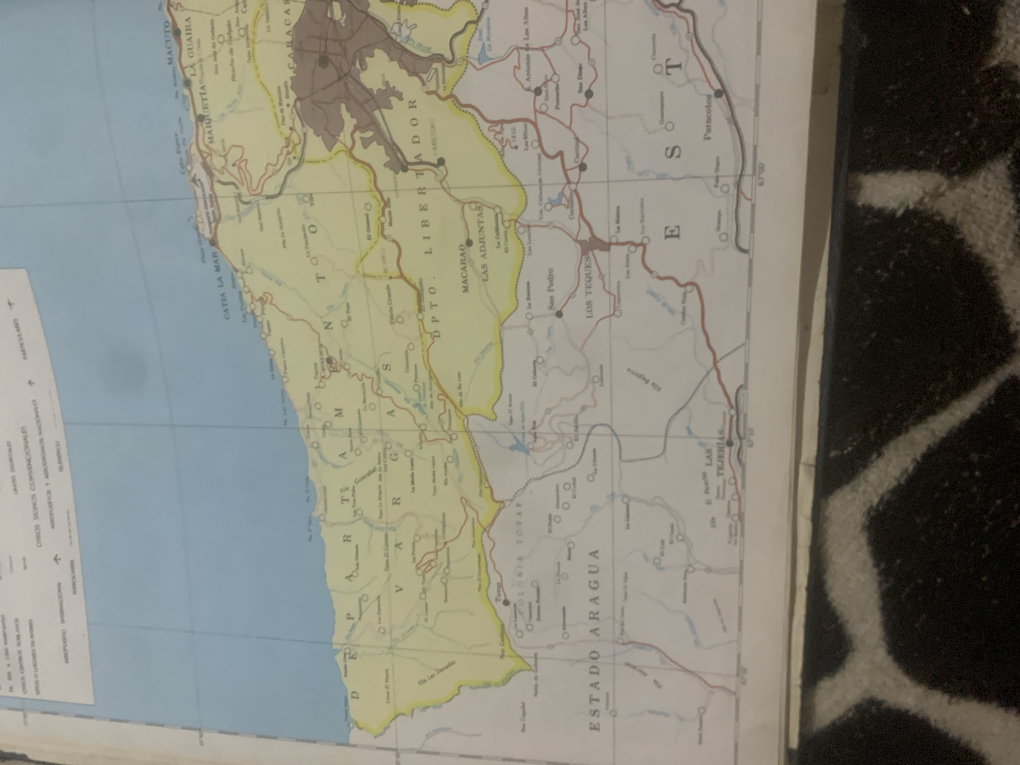
This is a photograph of a portion of a map, likely an old road map of Venezuela, with the focus on the coastal region near Caracas. The map is oriented such that the sea is to the left and the landmass extends to the right. Prominent geographical features and place names are visible, including "CATIA LA MAR," "MAIQUETIA," "LA GUAIRA," and "CARACAS" along the coast. Inland, areas like "MACARAO," "LAS ADJUNTAS," "LOS TEQUES," and "ESTADO ARAGUA" are marked. Roads are depicted as red lines, and bodies of water as blue. The map also includes symbols for airports, national airports, and other conventional signs. A legend in the bottom left corner provides keys for "OTROS SIGNOS CONVENCIONALES" (other conventional signs). The map appears to be placed on a dark, textured surface, possibly a rug, and the lighting suggests it might be an indoor setting. No people are visible in the image. The primary subject is the cartographic representation of the geographical area.
Symbol
DFA50
Volume
13,444
Creator
+$0.15
Revenue
+$0.18
TVL
$12.70


