Stake attention in this memory
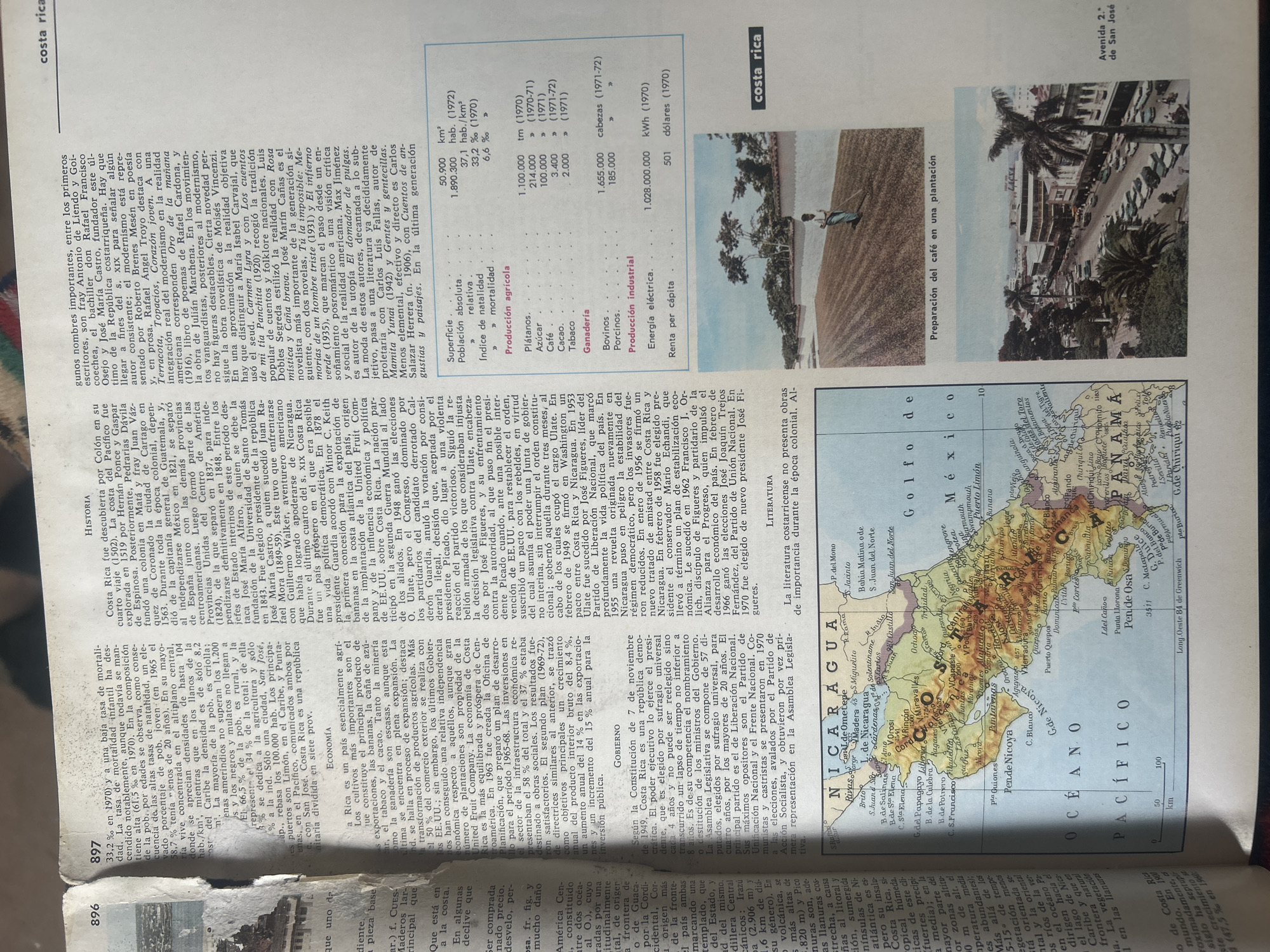
The image is a scan of a book page featuring a map of Central America and several photographs. The map is detailed, showing country borders, cities, bodies of water, and geographical features. Text overlays the map, providing labels and scale information in both kilometers and nautical miles. To the right of the map, there are three photographs. The top photograph, in color, depicts a street scene in a city, likely San José, Costa Rica, given the text "Avenida 2." de San José. It shows buildings, parked cars, and palm trees. The middle photograph, also in color, shows a person working in a coffee plantation, with rows of coffee plants stretching into the distance. The text below this image reads "Preparación del café en una plantación." The bottom photograph, in black and white, shows a panoramic view of a city with buildings and palm trees, possibly another part of San José. The page also contains a significant amount of text in columns, detailing historical and economic information about Costa Rica. Various headings and subheadings are visible, including "HISTORIA," "Economía," and "Producción agrícola." Statistical data, such as population figures, mortality rates, and production yields for crops like bananas, coffee, and sugar, are presented in tables. The overall impression is of an informative page from an encyclopedia or atlas, offering a multifaceted view of Costa Rica, encompassing its geography, history, economy, and visual culture. The text is predominantly in Spanish.
No transactions found