Sign in
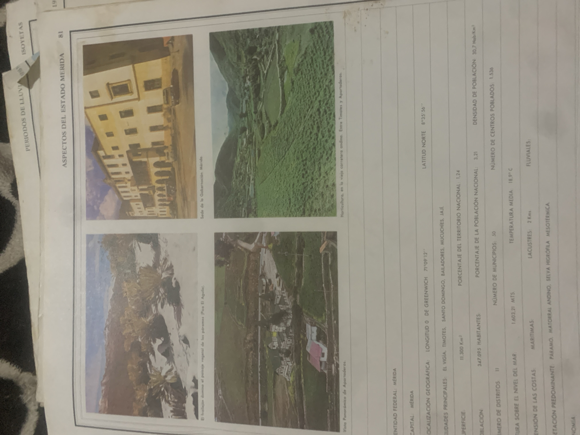
This media file appears to be a page from a publication, likely a geographical or statistical report, featuring several photographs related to the state of Mérida, Venezuela. The page is divided into sections, each with a photograph and accompanying text.

The top left photo shows the facade of a building, described as the "Sede de la Gobernación, Mérida" (Seat of the Government of Mérida). The building has multiple stories, arched windows on the ground floor, and a car parked in front. The style suggests historical architecture.

The top right photo depicts a landscape with a village or settlement nestled in a valley surrounded by lush green hills. The text identifies this as "Horticultura, en la vieja carretera andina. Entre Timotes y Apartaderos" (Horticulture, on the old Andean road. Between Timotes and Apartaderos). This indicates an agricultural scene in a mountainous region.

The bottom left photo showcases a mountain landscape with distinct vegetation, described as "El frallejón domina el paisaje vegetal de los páramos (Pico El Aguilaj)" (The frailejón dominates the páramo vegetation landscape (Pico El Águila)). The "frailejón" is a characteristic plant of the Andean páramos, suggesting high altitude and a unique ecosystem.

The bottom right photo presents a panoramic view of a settlement, labeled "Visto Panorámica de Apartaderos" (Panoramic View of Apartaderos). It shows houses with various roof colors, roads, and surrounding fields, suggesting a rural community.

The text on the page provides factual data about the state of Mérida, including its federal entity, capital, geographical location (latitude and longitude), major cities, surface area, population, population density, number of districts and municipalities, altitude, average temperature, coastal and lacustrine extensions, and predominant vegetation. The overall tone of the text is informative and statistical. There is no indication of people actively engaged in an event, but rather static representations of locations and data. The time of day and weather are not explicitly mentioned, but the lighting in the photographs suggests daylight.
bombolico

Jun 25, 2026, 2:30 PM

La Tagua, Venezuela

Moment

Stake attention in this memory

nostalgic
educational
serene
historical
reflective

This media file appears to be a page from a publication, likely a geographical or statistical report, featuring several photographs related to the state of Mérida, Venezuela. The page is divided into sections, each with a photograph and accompanying text. The top left photo shows the facade of a building, described as the "Sede de la Gobernación, Mérida" (Seat of the Government of Mérida). The building has multiple stories, arched windows on the ground floor, and a car parked in front. The style suggests historical architecture. The top right photo depicts a landscape with a village or settlement nestled in a valley surrounded by lush green hills. The text identifies this as "Horticultura, en la vieja carretera andina. Entre Timotes y Apartaderos" (Horticulture, on the old Andean road. Between Timotes and Apartaderos). This indicates an agricultural scene in a mountainous region. The bottom left photo showcases a mountain landscape with distinct vegetation, described as "El frallejón domina el paisaje vegetal de los páramos (Pico El Aguilaj)" (The frailejón dominates the páramo vegetation landscape (Pico El Águila)). The "frailejón" is a characteristic plant of the Andean páramos, suggesting high altitude and a unique ecosystem. The bottom right photo presents a panoramic view of a settlement, labeled "Visto Panorámica de Apartaderos" (Panoramic View of Apartaderos). It shows houses with various roof colors, roads, and surrounding fields, suggesting a rural community. The text on the page provides factual data about the state of Mérida, including its federal entity, capital, geographical location (latitude and longitude), major cities, surface area, population, population density, number of districts and municipalities, altitude, average temperature, coastal and lacustrine extensions, and predominant vegetation. The overall tone of the text is informative and statistical. There is no indication of people actively engaged in an event, but rather static representations of locations and data. The time of day and weather are not explicitly mentioned, but the lighting in the photographs suggests daylight.

Symbol

E2534

Volume

0

Creator

+$0.00

Revenue

+$0.00

TVL

$0.00

1D
1W
1M
All

Loading AttnAds…

transactions
revenues
stakers
Earliest
Latest
Highest stake

1

Katy

Staked 10d ago
Redeemed 4d ago

$0.05 USD

+$0.00 USD

Fee: $0.00 (0.25%)

+0.9%

2

Rev Bot 🤖💰

Injected revenue 10d ago

Revenue bonus for the last stake.

+$0.00 USD

More from this user

More from La Tagua

bombolico

Jun 25, 2026, 2:30 PM

La Tagua, Venezuela

Licensed under Creative Commons Attribution 4.0 International License. You are free to share and adapt this content with proper attribution.





