
Stake attention in this memory
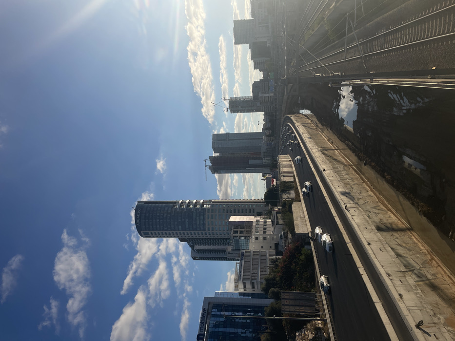
An aerial perspective depicts a multi-modal urban transportation corridor in Tel Aviv, Israel, specifically the area surrounding the Ayalon Highway (Highway 20) and the Ayalon River. The image is captured under a clear blue sky with scattered white cumulus clouds, with bright sunlight emanating from the upper right, casting long shadows indicative of late afternoon. In the background, prominent high-rise buildings define the city skyline. On the left, a dark-facaded building bears the "Mobileye" logo. To its right stands the distinctive cylindrical Azrieli Sarona Tower, marked with "ADGAR 360" at its apex. Further to the right, additional skyscrapers are visible, some under construction with visible tower cranes. The foreground and midground are dominated by infrastructure. A multi-lane highway, the Ayalon Highway, traverses the scene from foreground to background, curving slightly towards the right. It is contained within a concrete-lined depression. Multiple light-colored passenger vehicles are visible on the highway, traveling away from the viewer. To the immediate right of the highway, an unlined channel, identified as the Ayalon River, runs parallel. Its bed consists of exposed earth and mud, with sporadic pools of standing water reflecting the sky. To the right of the channel, a set of multiple parallel railway tracks is present, accompanied by overhead electrical lines. No trains are visible on the tracks. No individuals are discernible within the frame.
Loading AttnAds…
No transactions found