Stake attention in this memory
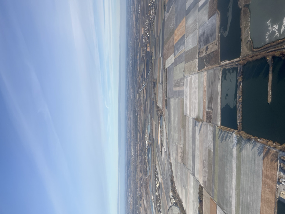
An aerial image captures a vast, flat, rural, and semi-urban landscape in the district of Erding, Germany, under a clear blue sky with minimal high-altitude cloud streaks. The scene is dominated by a mosaic of rectangular agricultural fields, many appearing light grey or white, consistent with frost, snow cover, or fallow earth, interspersed with patches of brown and darker tones. Numerous dark, irregularly shaped water bodies, characteristic of gravel pits, are prominent in the foreground and mid-ground, some exhibiting lighter, mottled patches indicative of partial ice formation. A distinct, straight canal or large channel traverses the mid-ground horizontally, extending from the left to the right side of the frame and appearing to connect with other water features. Clusters of buildings, representing residential settlements or villages, are visible in the mid-ground and distant background, notably to the right and left. In the mid-left, an industrial complex comprising several buildings and associated water retention ponds is discernible adjacent to the main canal. Sparse, bare deciduous trees line some field boundaries and water edges, casting elongated shadows consistent with a low sun angle, suggesting a winter or late autumn season. No people or specific actions are discernible due to the high altitude perspective.
No transactions found