Stake attention in this memory
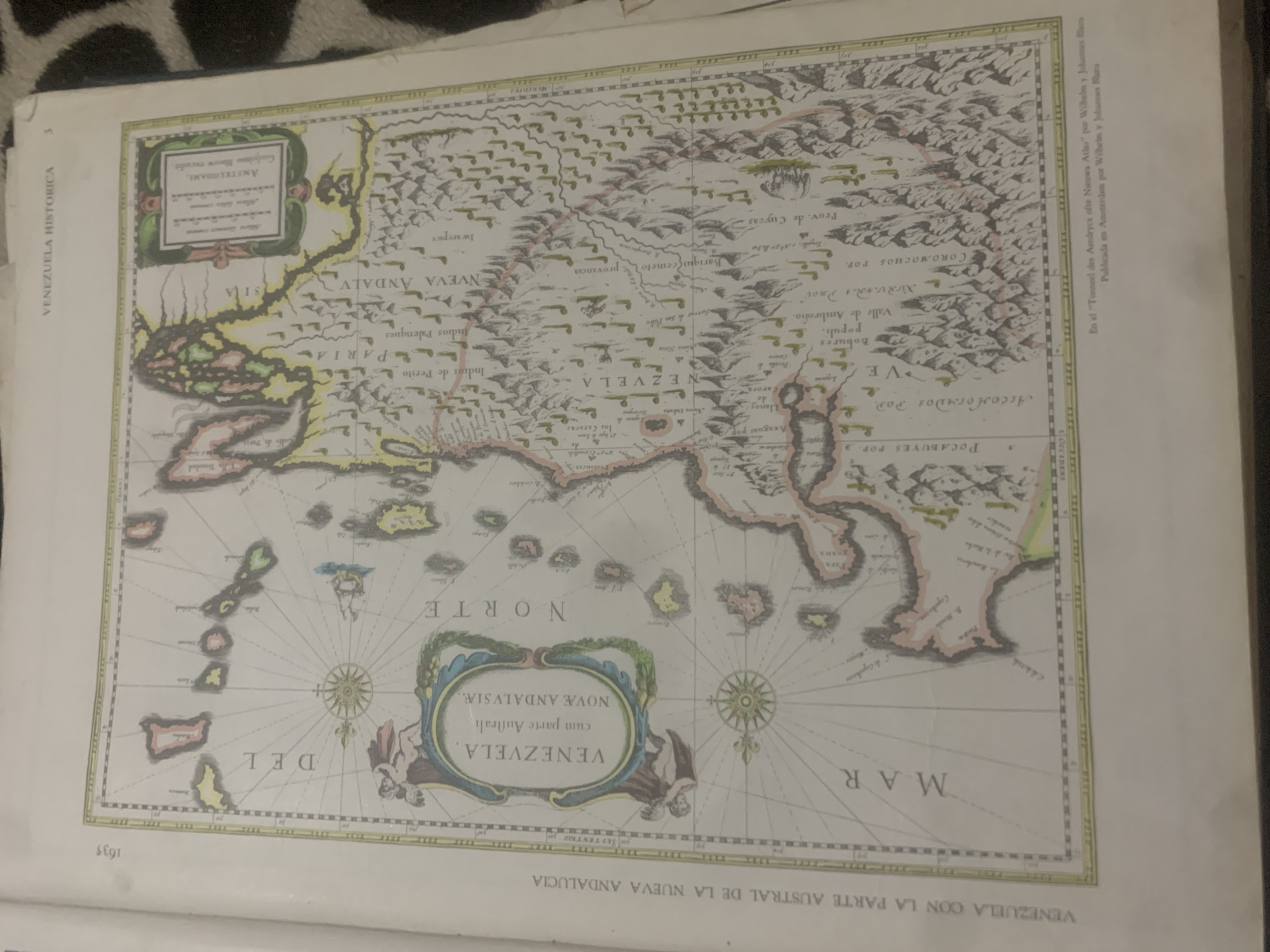
This media file is a scanned image of an old map of Venezuela, likely from the 17th century, given the text "1635" in the bottom left corner and the publication information at the top right: "En el 'Tonneel des Aerdrycx ofte Nieuws Atlas' por Wilhelm y Johannes Blacu. Publicada en Amsterdam por Wilhelm y Johannes Blacu." The map depicts the region of "VENEZUELA CON LA PARTE AUSTRAL DE LA NUEVA ANDALUCIA" and includes geographical features such as mountains, rivers, and bodies of water, as well as names of indigenous groups and settlements. There are decorative elements on the map, including cartouches with text and compass roses. The overall scene is that of a historical cartographic document, providing a glimpse into the geographical knowledge and naming conventions of the past. The image is slightly blurry, and the colors are muted, consistent with the age of the document. The title "VENEZUELA HISTORICA" is visible on the left side, indicating the context of the map.
Symbol
E6E63
Volume
11,550
Creator
+$0.14
Revenue
+$0.19
TVL
$11.63
2
Rev Bot 🤖💰
Injected revenue 6d ago
“Revenue bonus for the last stake.”
+$0.21 USD


