Stake attention in this memory
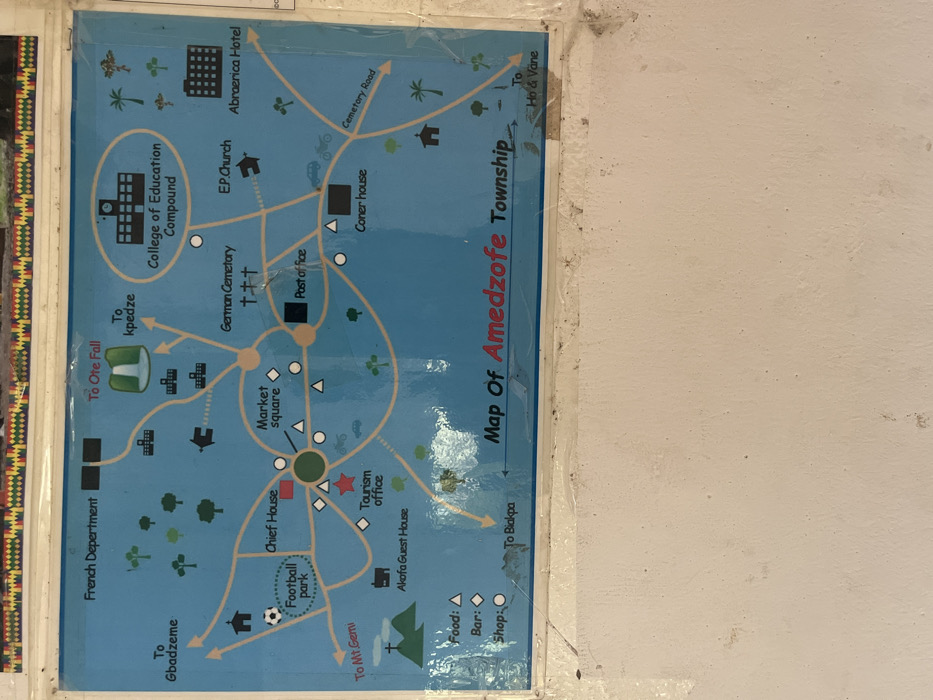
A laminated map titled "Map Of Amedzofe Township" is affixed to a textured, light-colored wall. The map features a blue background with yellow lines representing roads, displaying key locations such as the French Department, College of Education Compound, German Cemetery, EP Church, Abraerica Hotel, Chief House, Market Square, Post Office, Coner house, Tourism Office, and Akofa Guest House within Amedzofe, Ghana. Geographic and recreational features like Ote Fall, Mt Gemi, Football Park, and Cemetery Road are also depicted. Directional indicators point towards Gbadzeme, Kpedze, Biakpa, and Ho & Vane. A legend in the lower-left defines symbols for Food (triangle), Bar (diamond), and Shop (circle). The map surface shows glare, minor creases, and dirt accumulation, particularly at its lower edge. Above the map, a narrow decorative strip with a multicolored, geometric pattern is visible. The wall below the map is a light, possibly off-white, color, displaying dirt, dust, and an uneven texture.
No transactions found