Sign in
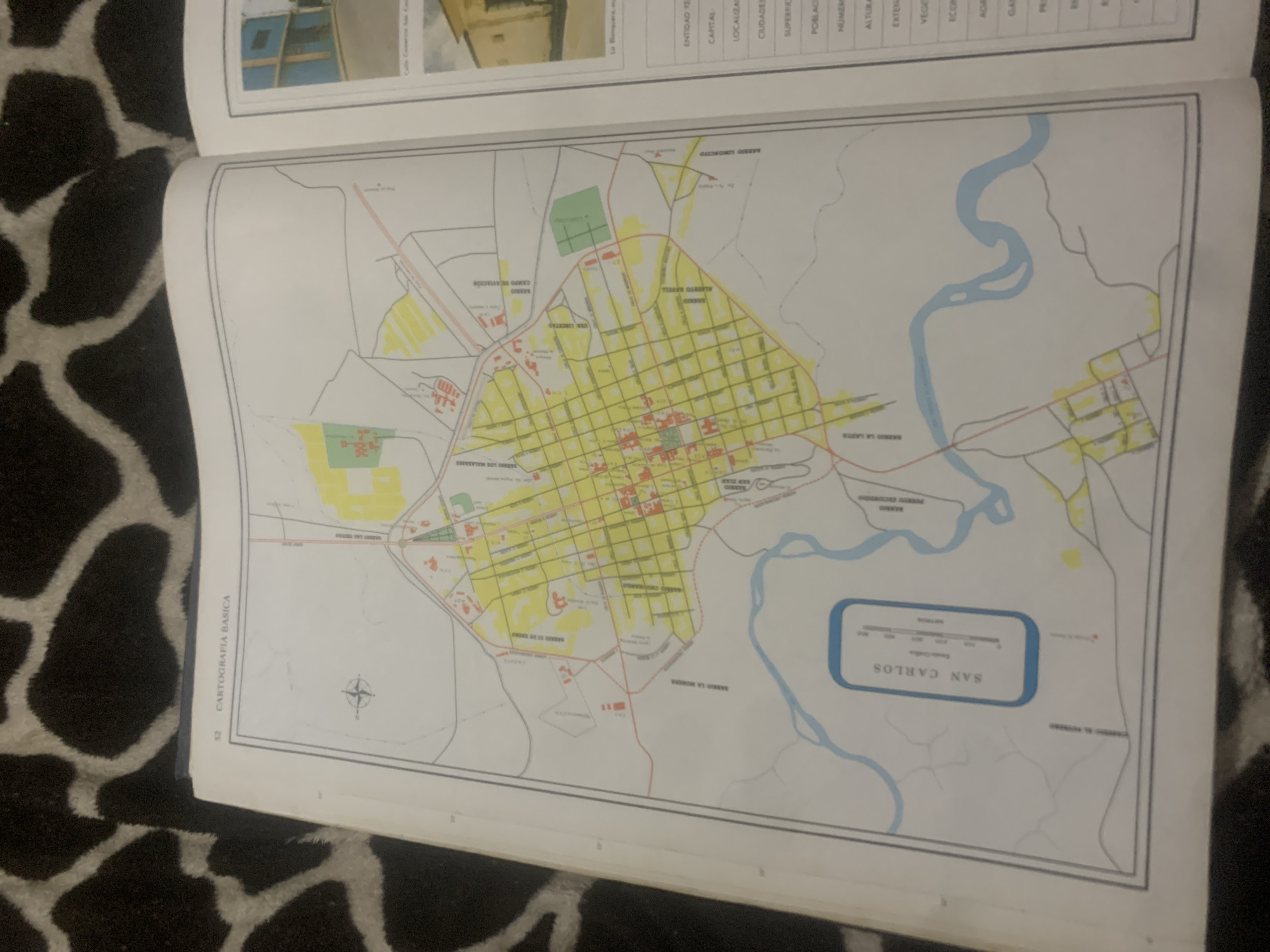
This media file contains an image of a map of San Carlos, Venezuela. The map is detailed, showing streets, neighborhoods, a river, and a campo de aviación (airport). Various barrios, or neighborhoods, are labeled, including Barrio San Juan, Barrio La Santa, and Barrio Los Malasares. A compass rose is visible in the lower left portion of the map. The map is part of a document with the title "CARTOGRAFIA BASICA," indicating it is a basic cartography document. The page number "52" is also visible. In the upper part of the image, a small portion of another page is visible, showing what appears to be a table with headings such as "ENTIDAD," "CAPITAL," "LOCALIZACION," and "CIUDADES." The map itself is colorful, with yellow highlighting indicating urban areas and a blue line representing the river. The map is laid open on a surface with a black and white patterned texture, possibly a rug or blanket. There are no people or specific activities depicted on the map itself. The overall impression is that of an informational or educational document focusing on the geography of San Carlos.
bombolico

Jun 25, 2026, 2:21 PM

La Tagua, Venezuela

Short Term

Stake attention in this memory

analytical
studious
methodical
nostalgic
composed

This media file contains an image of a map of San Carlos, Venezuela. The map is detailed, showing streets, neighborhoods, a river, and a campo de aviación (airport). Various barrios, or neighborhoods, are labeled, including Barrio San Juan, Barrio La Santa, and Barrio Los Malasares. A compass rose is visible in the lower left portion of the map. The map is part of a document with the title "CARTOGRAFIA BASICA," indicating it is a basic cartography document. The page number "52" is also visible. In the upper part of the image, a small portion of another page is visible, showing what appears to be a table with headings such as "ENTIDAD," "CAPITAL," "LOCALIZACION," and "CIUDADES." The map itself is colorful, with yellow highlighting indicating urban areas and a blue line representing the river. The map is laid open on a surface with a black and white patterned texture, possibly a rug or blanket. There are no people or specific activities depicted on the map itself. The overall impression is that of an informational or educational document focusing on the geography of San Carlos.

Symbol

EA99C

Volume

11,550

Creator

+$0.08

Revenue

+$0.11

TVL

$7.25

1D
1W
1M
All

Loading AttnAds…

transactions
revenues
stakers
Earliest
Latest
Highest stake

1

Katy

Staked 11d ago

$7.21 USD

+$0.04 USD

+0.5%

2

Rev Bot 🤖💰

Injected revenue 11d ago

Revenue bonus for the last stake.

+$0.12 USD

More from this user

More from La Tagua

bombolico

Jun 25, 2026, 2:21 PM

La Tagua, Venezuela

Licensed under Creative Commons Attribution 4.0 International License. You are free to share and adapt this content with proper attribution.





