
Sign in
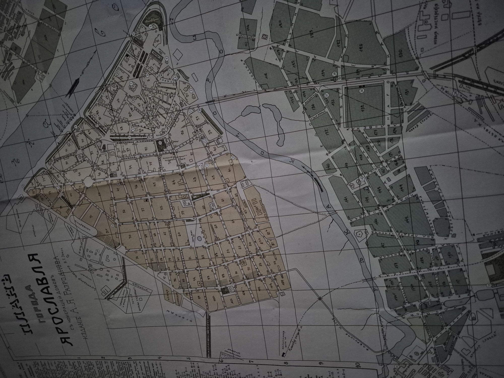
The image is a close-up, slightly angled view of an old, vintage map titled "ПЛАНЪ ГОРОДА ЯРОСЛАВЛЯ" which translates to "PLAN OF THE CITY OF YAROSLAVL". The map depicts a detailed street layout with numbered blocks and buildings. The style of the map suggests it is from the late 19th or early 20th century, indicated by the font and the overall aesthetic. There are handwritten annotations and some areas of color, possibly highlighting specific districts or types of buildings. The map is creased and shows signs of age, with some fading and discoloration. The environment appears to be indoors, with a dark, diffused lighting that casts a shadow on the map. There are no people or discernible actions taking place in the image.
FM-sAgTR2

Jul 29, 2026, 2:16 AM

Unknown, Unknown

Stake attention in this memory

nostalgic
historical
intricate
curious
detailed

The image is a close-up, slightly angled view of an old, vintage map titled "ПЛАНЪ ГОРОДА ЯРОСЛАВЛЯ" which translates to "PLAN OF THE CITY OF YAROSLAVL". The map depicts a detailed street layout with numbered blocks and buildings. The style of the map suggests it is from the late 19th or early 20th century, indicated by the font and the overall aesthetic. There are handwritten annotations and some areas of color, possibly highlighting specific districts or types of buildings. The map is creased and shows signs of age, with some fading and discoloration. The environment appears to be indoors, with a dark, diffused lighting that casts a shadow on the map. There are no people or discernible actions taking place in the image.

Loading AttnAds…

transactions
revenues
stakers
Earliest
Latest
Highest stake

No transactions found

More from Unknown

Nearby

this memory

nearby events

FM-sAgTR2

Jul 29, 2026, 2:16 AM

Unknown, Unknown

Licensed under Creative Commons Attribution 4.0 International License. You are free to share and adapt this content with proper attribution.